IMAGES TAKEN NEAR TO
John Martin Gardens, STONEHOUSE, GL10 3WB
Introduction
This page details the photographs taken nearby to John Martin Gardens, GL10 3WB by members of the Geograph project.
The Geograph project started in 2005 with the aim of publishing, organising and preserving representative images for every square kilometre of Great Britain, Ireland and the Isle of Man.

There are currently over 7.5m images from over14,400 individuals and you can help contribute to the project by visiting https://www.geograph.org.uk
Image Map
Images are licensed for reuse under creativecommons.org/licenses/by-sa/2.0
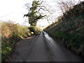
Notes
- Clicking on the map will re-center to the selected point.
- The higher the marker number, the further away the image location is from the centre of the postcode.
Image Listing (24 Images Found)
Images are licensed for reuse under creativecommons.org/licenses/by-sa/2.0
Image
Details
Distance
1
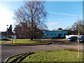
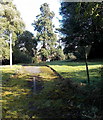
Stroud CLDT, Westridge, Standish Hospital
Stroud Community Learning Disabilities Team (CLDT) is a multi-disciplinary team based at Westridge (the former Standish Hospital). The team offers a co-ordinated service to people in the Stroud area with a learning disability, their carers and other professionals.
Image: © Jaggery
Taken: 17 Feb 2013
0.04 miles
2
Pedestrian Priority Zone, Standish Hospital, Standish
The sign on the approach road shows Pedestrian Priority Zone, but how does this work in practice,
when a car whizzes around the corner towards you?
Image: © Jaggery
Taken: 17 Feb 2013
0.05 miles
3
Entrance barrier, Standish Hospital
Standish Hospital is occupied by Westridge Assessment and Treatment Service
and Stroud CLDT (Community Learning Disabilities Team).
Image: © Jaggery
Taken: 17 Feb 2013
0.06 miles
4
10mph zone on the approach to Standish Hospital, Standish
Standish Hospital is now occupied by Westridge Assessment and Treatment Service
and Stroud CLDT (Community Learning Disabilities Team).
Image: © Jaggery
Taken: 17 Feb 2013
0.06 miles
5
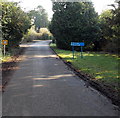
Disused side road, Standish Hospital, Standish
Moss grows on the abandoned road. The triangular traffic sign suggests that this was once a busy side road. Standish Hospital is now occupied by Westridge Assessment and Treatment Service and Stroud CLDT (Community Learning Disabilities Team).
Image: © Jaggery
Taken: 17 Feb 2013
0.07 miles
6
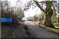
Track on the north side of Moreton Hill Farm, Standish
Looking north towards a building in Standish Hospital.
Image: © Jaggery
Taken: 17 Feb 2013
0.07 miles
7
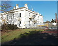
Main House and chimney stack, Standish Hospital, Standish
Standish Hospital is occupied by Westridge Assessment and Treatment Service and Stroud CLDT (Community Learning Disabilities Team). A notice of the fence shows Secured by VPS, so it may be that this building named Main House is no longer in use.
Image: © Jaggery
Taken: 17 Feb 2013
0.10 miles
8
Moreton Hill, Standish looking towards Stonehouse
Image: © Roger May
Taken: 21 Feb 2006
0.16 miles
9
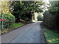
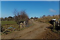
Passing place near Moreton Hill Farm, Standish
This is one of several passing places along a narrow road.
Image: © Jaggery
Taken: 17 Feb 2013
0.16 miles
10
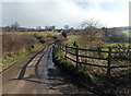
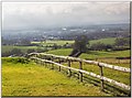
A fence and its shadow, Moreton Hill Farm, Standish
The road passes the fence at the northern edge of the farm.
Image: © Jaggery
Taken: 17 Feb 2013
0.16 miles