
IMAGES TAKEN NEAR TO
Avenue Terrace, STONEHOUSE, GL10 3RE
Introduction
This page details the photographs taken nearby to Avenue Terrace, GL10 3RE by members of the Geograph project.
The Geograph project started in 2005 with the aim of publishing, organising and preserving representative images for every square kilometre of Great Britain, Ireland and the Isle of Man.

There are currently over 7.5m images from over14,400 individuals and you can help contribute to the project by visiting https://www.geograph.org.uk
Image Map
Images are licensed for reuse under creativecommons.org/licenses/by-sa/2.0
Notes
- Clicking on the map will re-center to the selected point.
- The higher the marker number, the further away the image location is from the centre of the postcode.
Image Listing (128 Images Found)
Images are licensed for reuse under creativecommons.org/licenses/by-sa/2.0
Image
Details
Distance
1
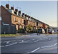
East along Avenue Terrace, Stonehouse
Viewed across the A419 Bristol Road.
Image: © Jaggery
Taken: 20 Nov 2022
0.03 miles
2
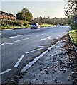
A419 towards the centre of Stonehouse, Gloucestershire
Looking to the ESE along the A419 here named Bristol Road.
Image: © Jaggery
Taken: 20 Nov 2022
0.03 miles
3
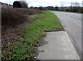
End of the pavement, Bristol Road, Stonehouse
Avenue Terrace houses https://www.geograph.org.uk/photo/5727537 are in the background on the left.
Image: © Jaggery
Taken: 1 Apr 2018
0.05 miles
4
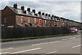
Avenue Terrace, Stonehouse
Avenue Terrace extends for 200 metres, set back from the north side of the A419 Bristol Road. The houses are not in one block. There are small gaps at intervals, which makes some of the houses semi-detached.
Image: © Jaggery
Taken: 1 Apr 2018
0.06 miles
5
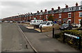
Avenue Terrace, Stonehouse
Avenue Terrace extends for 200 metres, set back about 40 metres from the north side of the A419 Bristol Road. The road in view is the access road, not the A419. The houses are not in one block.
There are small gaps at intervals, which makes most of the houses semi-detached.
Image: © Jaggery
Taken: 24 Mar 2013
0.07 miles
6
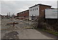
Entrance to Stonehouse Commercial Centre
From the A419 Bristol Road, near the eastern end of Avenue Terrace. http://www.geograph.org.uk/photo/3825280
Image: © Jaggery
Taken: 24 Mar 2013
0.07 miles
7
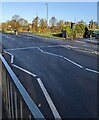
Bristol Road pelican crossing, Stonehouse
Across the A419 Bristol Road. Chambers Dictionary states that pelican in this context is adapted from "pedestrian light controlled crossing".
Image: © Jaggery
Taken: 20 Nov 2022
0.07 miles
8
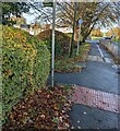
Public footpath direction sign, Bristol Road, Stonehouse
Pointing away from the A419 Bristol Road.
Image: © Jaggery
Taken: 20 Nov 2022
0.08 miles
9
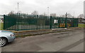
Wales & West Utilities gas installation near Avenue Terrace, Stonehouse
Located between Oldends Road and the western end of Avenue Terrace.
Image: © Jaggery
Taken: 24 Mar 2013
0.08 miles
10
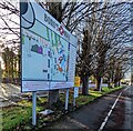
Bond's Mill information board, Stonehouse
The board shows the location of businesses and on the upper left, "You are here".
Image: © Jaggery
Taken: 20 Nov 2022
0.08 miles