
IMAGES TAKEN NEAR TO
Wigmore Green, STONEHOUSE, GL10 3QB
Introduction
This page details the photographs taken nearby to Wigmore Green, GL10 3QB by members of the Geograph project.
The Geograph project started in 2005 with the aim of publishing, organising and preserving representative images for every square kilometre of Great Britain, Ireland and the Isle of Man.

There are currently over 7.5m images from over14,400 individuals and you can help contribute to the project by visiting https://www.geograph.org.uk
Image Map
Images are licensed for reuse under creativecommons.org/licenses/by-sa/2.0
Notes
- Clicking on the map will re-center to the selected point.
- The higher the marker number, the further away the image location is from the centre of the postcode.
Image Listing (44 Images Found)
Images are licensed for reuse under creativecommons.org/licenses/by-sa/2.0
Image
Details
Distance
1
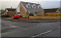
Corner of Broad Street and Orchard Close, Middleyard
Viewed across Broad Street.
Image: © Jaggery
Taken: 20 Nov 2011
0.02 miles
2
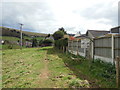
The Cotswold Way at Middleyard
The Cotswold Way, day three 2:39pm
Image: © Ian S
Taken: 19 Apr 2013
0.03 miles
3
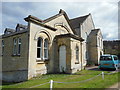
The Kings Stanley Baptist Church, Middleyard
The Cotswold Way, day three 2:40pm
Image: © Ian S
Taken: 19 Apr 2013
0.04 miles
4
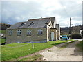
The Kings Stanley Baptist Church, Middleyard
The Cotswold Way, day three 2:40pm
Image: © Ian S
Taken: 19 Apr 2013
0.04 miles
5
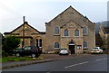
King's Stanley Baptist Church, Middleyard
The church in Broad Street Middleyard was built in 1824. The schoolroom http://www.geograph.org.uk/photo/3222672 on the left was added in 1883. The church building has the inscription BAPTIST CHURCH FOUNDED 1640, which is the year of the earliest surviving records of a Baptist fellowship in the King's Stanley area. At that time, it was illegal to meet for worship anywhere other than in a Church of England church. The local Baptists worshipped secretly in one of their homes. They were Seventh Day Baptists who met for worship on Saturdays, not Sundays.
Image: © Jaggery
Taken: 20 Nov 2011
0.04 miles
6
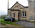
Baptist schoolroom, Middleyard
The schoolroom was built in 1883 alongside the church http://www.geograph.org.uk/photo/3222651 built in 1824.
A sign in front of the schoolroom shows that the path is part of the Cotswolds Way.
Image: © Jaggery
Taken: 20 Nov 2011
0.04 miles
7
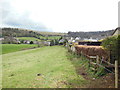
The Cotswold Way at Middleyard
The Cotswold Way, day three 2:39pm
Image: © Ian S
Taken: 19 Apr 2013
0.04 miles
8
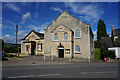
King's Stanley Baptist Church
Situated in the neighbouring village of Middleyard.
Image: © Bill Boaden
Taken: 17 Jul 2016
0.04 miles
9
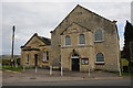
Baptist Church, Middleyard
A Baptist Church in Middleyard near King's Stanley which was founded in 1640 though clearly this church is much later.
Image: © Philip Halling
Taken: 29 Oct 2011
0.04 miles
10
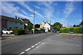
The junction of Orchard Close and Broad Street
Although in a village, this view looks very suburban.
Image: © Bill Boaden
Taken: 18 Jul 2016
0.04 miles