1
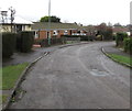
Bend in Brimley, Leonard Stanley
The road named Brimley follows a roughly semicircular route on the east side of Bath Road.
Image: © Jaggery
Taken: 22 Dec 2017
0.08 miles
2
Metal framed bungalows, Brimley, Leonard Stanley
The wall of the bungalow on the left is clad in brick in December 2017.
Image: © Jaggery
Taken: 22 Dec 2017
0.08 miles
3
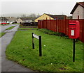
Brockley Road, Leonard Stanley
Viewed across Bath Road.
Image: © Jaggery
Taken: 22 Dec 2017
0.09 miles
4
Beeches Close bungalows, King's Stanley
This side of the street is named Beeches Close. The opposite side, out of shot, is The Beeches.
Image: © Jaggery
Taken: 20 Nov 2011
0.09 miles
5
Bus shelter and red phonebox, Bath Road, Leonard Stanley
Located between the Brockley Road junction and the Brimley junction.
Image: © Jaggery
Taken: 22 Dec 2017
0.11 miles
6
Queen Elizabeth II postbox, Brockley Road, Leonard Stanley
On the right here https://www.geograph.org.uk/photo/5632808 on the corner of Bath Road.
Image: © Jaggery
Taken: 22 Dec 2017
0.11 miles
7
Zigzag yellow markings on Bath Road, Leonard Stanley
Marking the Keep Clear Zone near the entrance https://www.geograph.org.uk/photo/5632766 to Leonard Stanley Church of England Primary School.
Image: © Jaggery
Taken: 22 Dec 2017
0.12 miles
8
Entrance to Leonard Stanley Church of England Primary School
This entrance is from Bath Road, Leonard Stanley.
Image: © Jaggery
Taken: 22 Dec 2017
0.13 miles
9
Brimley, Leonard Stanley
The southeast part of Brimley viewed across Bath Road.
The course of the Brimley roadway is roughly semicircular.
It rejoins Bath Road 175 metres to the northwest.
Image: © Jaggery
Taken: 22 Dec 2017
0.13 miles
10
King's Stanley (Glos) St George's Church
The churchyard is exceptionally large and there is an avenue of clipped yew trees .
Image: © ChurchCrawler
Taken: Unknown
0.14 miles


