
IMAGES TAKEN NEAR TO
Bath Road, STONEHOUSE, GL10 3JG
Introduction
This page details the photographs taken nearby to Bath Road, GL10 3JG by members of the Geograph project.
The Geograph project started in 2005 with the aim of publishing, organising and preserving representative images for every square kilometre of Great Britain, Ireland and the Isle of Man.

There are currently over 7.5m images from over14,400 individuals and you can help contribute to the project by visiting https://www.geograph.org.uk
Image Map
Images are licensed for reuse under creativecommons.org/licenses/by-sa/2.0
Notes
- Clicking on the map will re-center to the selected point.
- The higher the marker number, the further away the image location is from the centre of the postcode.
Image Listing (109 Images Found)
Images are licensed for reuse under creativecommons.org/licenses/by-sa/2.0
Image
Details
Distance
1
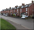
Bath Road houses, King's Stanley
Near the Leonard Stanley boundary sign behind the camera.
Image: © Jaggery
Taken: 22 Dec 2017
0.01 miles
2
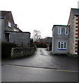
Entrance to Allen-White funeral directors, Crown Mews, Bath Road, King's Stanley
The Allen-White building https://www.geograph.org.uk/photo/5632698 is set back 25 metres from Bath Road.
Image: © Jaggery
Taken: 22 Dec 2017
0.01 miles
3
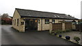
Allen-White funeral directors, Crown Mews, King's Stanley
Set back from the south side of Bath Road.
Image: © Jaggery
Taken: 22 Dec 2017
0.02 miles
4
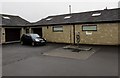
Disused fuel pump, Crown Mews, King's Stanley
Located at the rear of Allen-White funeral directors. https://www.geograph.org.uk/photo/5632698 The notice on the wall shows
PETROLEUM SPIRIT - HIGHLY FLAMMABLE - SWITCH OFF ENGINE.
The pump owner said that the pump is currently (December 2017) not in use - its underground fuel tank is empty.
Image: © Jaggery
Taken: 22 Dec 2017
0.02 miles
5
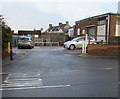
Goods Inward area, Bath Road, King's Stanley
This area on the west side of the Co-operative Food store https://www.geograph.org.uk/photo/5633258 is where stock brought by lorries is unloaded.
Image: © Jaggery
Taken: 22 Dec 2017
0.03 miles
6
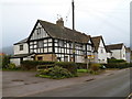
Grade II listed The Cottage, King's Stanley
Located on the east side of High Street, The Cottage probably dates from the 15th century. It is part of a row of four houses Grade II listed in February 1987.
Image: © Jaggery
Taken: 20 Nov 2011
0.03 miles
7
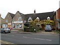
Yew Tree Stores and site of former village post office, King's Stanley
Now a High Street newsagents, Yew Tree Stores was formerly much larger. For decades it was the village general stores and post office. The current post office is now located a few metres away,
inside a Co-operative Food store. http://www.geograph.org.uk/photo/2702486
Image: © Jaggery
Taken: 20 Nov 2011
0.03 miles
8
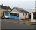
Mayo's Garage, King's Stanley
Premises of L.Mayo & Son, located on High Street nearly opposite Yew Tree Stores. http://www.geograph.org.uk/photo/2702491
Image: © Jaggery
Taken: 20 Nov 2011
0.03 miles
9
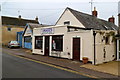
Images unisex hair salon, King's Stanley
Located on High Street, next door to Mayo's garage. http://www.geograph.org.uk/photo/2702507
Image: © Jaggery
Taken: 20 Nov 2011
0.03 miles
10
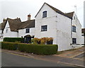
Grade II listed The Old Wool Shop, King's Stanley
Located at the southern end of a row of four High Street houses grade II listed in 1987.
The Cottage http://www.geograph.org.uk/photo/2702373 is at the far side of the row.
Image: © Jaggery
Taken: 20 Nov 2011
0.03 miles