
IMAGES TAKEN NEAR TO
Standish, STONEHOUSE, GL10 3DW
Introduction
This page details the photographs taken nearby to GL10 3DW by members of the Geograph project.
The Geograph project started in 2005 with the aim of publishing, organising and preserving representative images for every square kilometre of Great Britain, Ireland and the Isle of Man.

There are currently over 7.5m images from over14,400 individuals and you can help contribute to the project by visiting https://www.geograph.org.uk
Image Map
Images are licensed for reuse under creativecommons.org/licenses/by-sa/2.0
Notes
- Clicking on the map will re-center to the selected point.
- The higher the marker number, the further away the image location is from the centre of the postcode.
Image Listing (59 Images Found)
Images are licensed for reuse under creativecommons.org/licenses/by-sa/2.0
Image
Details
Distance
1
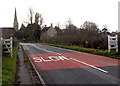
Standish Church viewed from the north
The spire http://www.geograph.org.uk/photo/3281292 of Grade I listed St Nicholas Church Standish is a prominent landmark, viewed here from the B4008 Gloucester Road. A few hundred metres away, there is a similar roadside church name sign (in the same style as village boundary signs in this part of Gloucestershire). http://www.geograph.org.uk/photo/3295420
Image: © Jaggery
Taken: 23 Dec 2012
0.03 miles
2
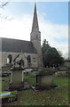
Spire of the Grade I listed St Nicholas Church, Standish
The thin spire is at the western end of the Anglican parish church of St Nicholas.
The church, dating from the early 14th century, was restored in the 1860s.
In January 1955, the church was given Grade I listing, the highest category.
Image: © Jaggery
Taken: 23 Dec 2012
0.03 miles
3
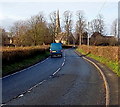
A glimpse of the church spire, Standish
This view of the spire http://www.geograph.org.uk/photo/3281292 along the B4008 Gloucester Road can be had only when the trees are bare. A full canopy of leaves screens the church from this side.
Image: © Jaggery
Taken: 23 Dec 2012
0.03 miles
4
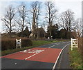
Standish Church
Grade I listed St Nicholas Church, Standish, has its own roadside name sign in the same style as village boundary signs in this part of Gloucestershire. The tower http://www.geograph.org.uk/photo/3281292 is a prominent landmark, though sight of it from this side is obscured when the trees are in leaf.
Image: © Jaggery
Taken: 23 Dec 2012
0.03 miles
5
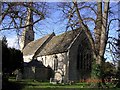
Standish. St. Nicholas
The village hall is just visible to the right of the church.
Image: © Anonymous 4610
Taken: 24 Jan 2004
0.04 miles
6
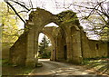
Gatehouse, Standish Court
The 14th century gatehouse to Standish Court, which is in better condition.
Image: © Philip Pankhurst
Taken: 27 Apr 2013
0.04 miles
7
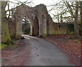
Grade II* listed Almonry Gateway, Standish
This is the ruined gateway or gatehouse to the house built for the Abbot of Gloucester,
probably in the 14th century. Grade II* listed in January 1955.
Image: © Jaggery
Taken: 23 Dec 2012
0.04 miles
8
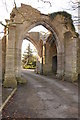
Remains of the gatehouse, Standish Court
The remains of the 14th century gatehouse to Standish Court is situated immediately to the west of Standish church.
Image: © Philip Halling
Taken: 11 Feb 2012
0.04 miles
9
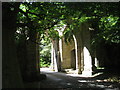
The remains of the Gatehouse to Standish Court
Image: © Jonathan Thacker
Taken: 9 Jul 2010
0.04 miles
10
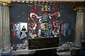
Memorial to Sir Henry Winston
Memorial to Sir Henry Winston who died in 1611 and is ancestor of Sir Winston Church. He held the manor of Standish and his daughter married John Churchill which is how Winston became a first name in the Churchill family. The inscription reads:
'This monument to Sir Henry Winston was restored to commemorate the marriage in 1618 of his daughter Sarah to John Churchill from which union descended Sir Winston Churchill K.G. O.M. C.H. M.P. 1874-1965 Prime Minister 1940-1945. 1951-1955'
Image: © Philip Halling
Taken: 11 Feb 2012
0.04 miles