
IMAGES TAKEN NEAR TO
Queens Road, STONEHOUSE, GL10 2QF
Introduction
This page details the photographs taken nearby to Queens Road, GL10 2QF by members of the Geograph project.
The Geograph project started in 2005 with the aim of publishing, organising and preserving representative images for every square kilometre of Great Britain, Ireland and the Isle of Man.

There are currently over 7.5m images from over14,400 individuals and you can help contribute to the project by visiting https://www.geograph.org.uk
Image Map
Images are licensed for reuse under creativecommons.org/licenses/by-sa/2.0
Notes
- Clicking on the map will re-center to the selected point.
- The higher the marker number, the further away the image location is from the centre of the postcode.
Image Listing (964 Images Found)
Images are licensed for reuse under creativecommons.org/licenses/by-sa/2.0
Image
Details
Distance
1
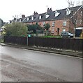
Upper Queen's Road houses, Stonehouse
Row of houses on the Verney Road side of Upper Queen's Road.
Image: © Jaggery
Taken: 2 Apr 2023
0.00 miles
2
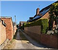
Side lane in Stonehouse, Gloucestershire
Looking to the NW from Verney Road.
Image: © Jaggery
Taken: 4 Jun 2023
0.01 miles
3
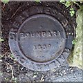
Old Boundary Marker
Railway Boundary Marker on the south side of Upper Queens Road next to a footpath and wall, 10 feet from the station platform. STONEHOUSE parish. GREAT WESTERN RAILWAY Cos in raised lettering on its outer edge and BOUNDARY / 1889 in raised lettering in its centre.
Milestone Society National ID: GL_STONE01em
Image: © Mr Red
Taken: 14 Feb 2019
0.02 miles
4
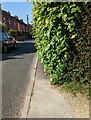
Blocked pavement, Verney Road, Stonehouse, Gloucestershire
Viewed on June 4th 2023. Recent vigorous growth here requires walkers to step into the roadway.
Image: © Jaggery
Taken: 4 Jun 2023
0.02 miles
5
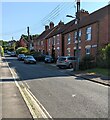
Brick houses in shadow, Stonehouse, Gloucestershire
Viewed across Verney Road.
Image: © Jaggery
Taken: 4 Jun 2023
0.03 miles
6
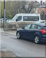
Jay Bee van, Upper Queen's Road, Stonehouse
OUR REPUTATION IS YOUR GUARANTEE is on the side
of the Jay Bee Plant Sales Ltd van in April 2023.
Image: © Jaggery
Taken: 2 Apr 2023
0.03 miles
7
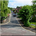
Verney Road, Stonehouse
From the corner of Rosedale Avenue, Verney Road ascends towards Bramble Lane.
Viewed from Stonehouse railway station footbridge.
Image: © Jaggery
Taken: 7 May 2017
0.03 miles
8
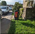
Bin 1284, Upper Queen's Road, Stonehouse
The number 1284 is on the side of the red bin for dog waste in June 2023.
Image: © Jaggery
Taken: 25 Jun 2023
0.03 miles
9
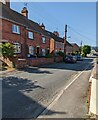
Verney Road houses, Stonehouse, Gloucestershire
Alongside the descent towards Stonehouse railway station.
Image: © Jaggery
Taken: 4 Jun 2023
0.03 miles
10
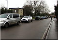
Upper Queen's Road towards Queen's Road, Stonehouse
The vehicles are parked near railings at the edge of Stonehouse railway station platform 1.
The small building is a station shelter. https://www.geograph.org.uk/photo/6376726
Image: © Jaggery
Taken: 26 Jan 2020
0.03 miles