
IMAGES TAKEN NEAR TO
Laburnum Walk, STONEHOUSE, GL10 2NE
Introduction
This page details the photographs taken nearby to Laburnum Walk, GL10 2NE by members of the Geograph project.
The Geograph project started in 2005 with the aim of publishing, organising and preserving representative images for every square kilometre of Great Britain, Ireland and the Isle of Man.

There are currently over 7.5m images from over14,400 individuals and you can help contribute to the project by visiting https://www.geograph.org.uk
Image Map
Images are licensed for reuse under creativecommons.org/licenses/by-sa/2.0
Notes
- Clicking on the map will re-center to the selected point.
- The higher the marker number, the further away the image location is from the centre of the postcode.
Image Listing (999 Images Found)
Images are licensed for reuse under creativecommons.org/licenses/by-sa/2.0
Image
Details
Distance
1
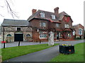
Pharmacy and medical centre, Stonehouse
Located side-by-side on the east side of High Street are Stonehouse Pharmacy on the left, and High Street Medical Centre on the right.
Image: © Jaggery
Taken: 20 Nov 2011
0.01 miles
2

Grade II listed Tudor House, Stonehouse
The black and white timber-frame building is at 30 High Street on the corner of Laburnum Walk.
It was built as a house in the 17th century, altered in the late 18th century. Formerly in use as offices, now the premises of Tudor Tandoori takeaway. The building was Grade II listed in February 1987.
Image: © Jaggery
Taken: 18 Dec 2011
0.01 miles
3

Co-op lorry, Laburnum Walk, Stonehouse
Travelling towards High Street in April 2022.
Image: © Jaggery
Taken: 24 Apr 2022
0.01 miles
4

WSW along Laburnum Walk, Stonehouse
Viewed across the B4008 High Street.
Image: © Jaggery
Taken: 1 Jan 2023
0.01 miles
5
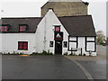
South side of Tudor Tandoori, Stonehouse
Laburnum Walk side of Tudor Tandoori takeaway at 30 High Street.
Image: © Jaggery
Taken: 3 Nov 2019
0.01 miles
6

Tudor Tandoori name sign, Stonehouse
Located here. https://www.geograph.org.uk/photo/6313551
Image: © Jaggery
Taken: 3 Nov 2019
0.01 miles
7

Stonehouse Tudor House
The building is a later example of the Tudor period, being early-mid seventeenth century in origin. It began life in residential use but in the latest times became an office and is now a Tandoori takeaway. Grade II listed.
Image: © Neil Owen
Taken: 7 Feb 2023
0.01 miles
8
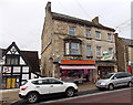
Broomhall Butchers, Stonehouse
J Broomhall Ltd's shop is at 32 High Street.
The black and white building on the left is the premises of Tudor Tandoori. http://www.geograph.org.uk/photo/3252065
Image: © Jaggery
Taken: 23 Dec 2012
0.01 miles
9
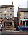
Paula's Shop, Stonehouse
There is a lot of information visible about the past and present usage of this small shop at 34 High Street.
A name board on the right side of the shop shows Paula's Shop, supporting residents of Wisma Mulia retirement home. It is unclear whether the estate agents' board at first floor level refers to the upstairs accommodation, or to the whole premises. Behind the estate agents' board is the name of a previous occupier, OJ's takeaway.
The name sign above the shop windows shows an earlier still, perhaps original, usage:
BREAD AND CAKE MAKERS EST. 1790.
Image: © Jaggery
Taken: 23 Dec 2012
0.01 miles
10
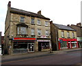
Bargain Brand Foods in Stonehouse
The High Street shop centre left is next door to J.Broomhall butchers.
Peking Chef http://www.geograph.org.uk/photo/4385624 is on the right.
Image: © Jaggery
Taken: 15 Mar 2015
0.01 miles