1
Northern end of Midland Road, Stonehouse
Looking south across Oldends Lane. The sign on left shows that the 30mph speed limit drops to 20mph.
Image: © Jaggery
Taken: 22 Apr 2018
0.02 miles
2
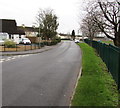
North along Midland Road, Stonehouse
Towards Oldends Lane.
Image: © Jaggery
Taken: 22 Apr 2018
0.02 miles
3
West along Oldends Lane, Stonehouse
Viewed from opposite the Ryelands Road junction http://www.geograph.org.uk/photo/4765371 looking towards the Midland Road junction.
Image: © Jaggery
Taken: 13 Dec 2015
0.02 miles
4
Grass triangle, Midland Road, Stonehouse
Paths from Midland Road to Oldends Lane diverge past a grass triangle.
Image: © Jaggery
Taken: 22 Apr 2018
0.03 miles
5
STOP when lights show, Oldends Lane, Stonehouse
The level crossing warning sign on the corner of Midland Road
is about 150 metres from this https://www.geograph.org.uk/photo/6428590 level crossing.
Image: © Jaggery
Taken: 22 Apr 2018
0.03 miles
6
Oldends Lane Stonehouse From Railway
Image: © Roy Hughes
Taken: 27 Oct 2018
0.04 miles
7
Junction of Severn Road and Midland Road, Stonehouse
White painted triangles are on the speed bump at the northern end of Severn Road.
Image: © Jaggery
Taken: 22 Apr 2018
0.04 miles
8
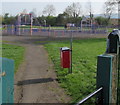
Path towards a multisports court, Stonehouse
Path from Oldends Lane into a recreation ground.
Image: © Jaggery
Taken: 22 Apr 2018
0.05 miles
9
Warning signs alongside Oldends Lane, Stonehouse
Facing eastbound traffic on the approach to a railway bridge. https://www.geograph.org.uk/photo/6428745
Image: © Jaggery
Taken: 22 Apr 2018
0.05 miles
10
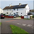
Rooftop solar panels, Midland Road, Stonehouse
Viewed from the corner of Severn Road.
Image: © Jaggery
Taken: 22 Apr 2018
0.05 miles


