IMAGES TAKEN NEAR TO
Regent Street, STONEHOUSE, GL10 2AD
Introduction
This page details the photographs taken nearby to Regent Street, GL10 2AD by members of the Geograph project.
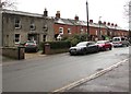
The Geograph project started in 2005 with the aim of publishing, organising and preserving representative images for every square kilometre of Great Britain, Ireland and the Isle of Man.

There are currently over 7.5m images from over14,400 individuals and you can help contribute to the project by visiting https://www.geograph.org.uk
Image Map
Images are licensed for reuse under creativecommons.org/licenses/by-sa/2.0
Notes
- Clicking on the map will re-center to the selected point.
- The higher the marker number, the further away the image location is from the centre of the postcode.
Image Listing (898 Images Found)
Images are licensed for reuse under creativecommons.org/licenses/by-sa/2.0
Image
Details
Distance
1
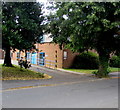
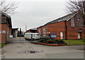
Wycliffe College entrance gate 9, Stonehouse
From Regent Street.
Image: © Jaggery
Taken: 7 Aug 2016
0.01 miles
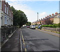
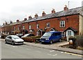
2
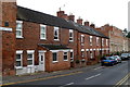
Regent Street houses, Stonehouse
Viewed from the Bath Road end.
Image: © Jaggery
Taken: 20 Nov 2011
0.01 miles
3
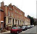
Regent Street houses, Stonehouse
The houses date from c1820.
Image: © Jaggery
Taken: 24 Mar 2013
0.01 miles
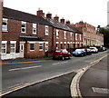
4
On-street parking, Regent Street, Stonehouse
Double yellow lines on the right indicate no parking at any time.
Parking on the left is for permit holders only.
Image: © Jaggery
Taken: 7 Aug 2016
0.01 miles
5
Gate 10 entrance to Wycliffe, Stonehouse
Viewed across Regent Street. Wycliffe is a day and boarding school for boys and girls aged from 2 to 18.
Image: © Jaggery
Taken: 24 Mar 2013
0.02 miles
6
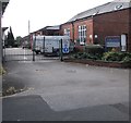
Wycliffe College entrance gate 10, Stonehouse
From Regent Street.
Image: © Jaggery
Taken: 7 Aug 2016
0.02 miles
7
View to the SW along Regent Street, Stonehouse
Formerly, Regent Street was a through route from the B4008 to the A419 Bristol Road. Now in July 2020, and for many years previously, only walkers and cyclists can reach the A419 out of shot ahead. Railings https://www.geograph.org.uk/photo/5065903 block the passage of motor vehicles.
Image: © Jaggery
Taken: 19 Jul 2020
0.02 miles
8
On-street parking, Regent Street, Stonehouse
Viewed from the corner of High Street on Sunday July 19th 2020.
Image: © Jaggery
Taken: 19 Jul 2020
0.02 miles
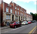
9
Regent Street houses, Stonehouse
A small part of Regent Street which extends for 350 metres from
Bristol Road in the south to High Street and Bath Road in the north.
Image: © Jaggery
Taken: 13 Dec 2017
0.02 miles
10
Regent Street houses, Stonehouse
Viewed looking SW in the direction of Regency Close.
Image: © Jaggery
Taken: 24 Mar 2013
0.03 miles