
IMAGES TAKEN NEAR TO
George Street, HELENSBURGH, G84 7EX
Introduction
This page details the photographs taken nearby to George Street, G84 7EX by members of the Geograph project.
The Geograph project started in 2005 with the aim of publishing, organising and preserving representative images for every square kilometre of Great Britain, Ireland and the Isle of Man.

There are currently over 7.5m images from over14,400 individuals and you can help contribute to the project by visiting https://www.geograph.org.uk
Image Map
Images are licensed for reuse under creativecommons.org/licenses/by-sa/2.0
Notes
- Clicking on the map will re-center to the selected point.
- The higher the marker number, the further away the image location is from the centre of the postcode.
Image Listing (47 Images Found)
Images are licensed for reuse under creativecommons.org/licenses/by-sa/2.0
Image
Details
Distance
1
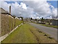
King's Crescent
Image: © Lairich Rig
Taken: 27 Mar 2013
0.12 miles
2

Helensburgh from the air
The south end of the West Highland railway line snakes diagonally through the scene. Viewed while banking to the left on approach to Glasgow Airport.
Image: © Thomas Nugent
Taken: 16 May 2026
0.12 miles
3
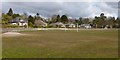
Eastend Public Park
Image: © Lairich Rig
Taken: 27 Mar 2013
0.13 miles
4
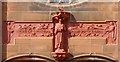
St Joseph's R.C. Church: detail
"Sancte Joseph, ora pro nobis". See Image for the whole building in context, and for further details.
Image: © Lairich Rig
Taken: 27 Mar 2013
0.15 miles
5
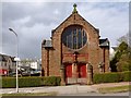
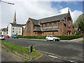
St Joseph's R.C. Church
The church (1911) was designed by the Belgian-born C J Menart. It is located on the corner of Lomond Street and East King Street. Another contributor's earlier photograph shows it from a different angle: Image
See Image for a closer view of the details above the entrance.
Image: © Lairich Rig
Taken: 27 Mar 2013
0.15 miles
6
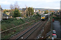
Train approaching Helensburgh Central
EMU 334002 just to the east of Helensburgh Central station. The railway line here is a single track branch leading from the double track mainline at Craigendoran.
Image: © Richard Sutcliffe
Taken: 24 Dec 2019
0.16 miles
7
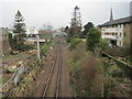
Helensburgh 1st railway station (site), Argyll & Bute
This is believed to have been the site of the short-lived first railway station (c.1857-1863) on the line which today runs to Helensburgh Central station, before the line was extended to the current terminus.
View west from George Street footbridge towards Helensburgh Central.
Image: © Nigel Thompson
Taken: 29 Mar 2014
0.17 miles
9
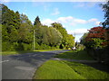
West end of St Michael Drive, Helensburgh
Off Charlotte Street.
Image: © Richard Vince
Taken: 13 Sep 2022
0.17 miles
10
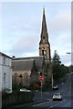
Meditation Centre of Scotland
Former Park Church, built in 1862, which is Category B listed http://portal.historicenvironment.scot/designation/LB34714.
Image: © Richard Sutcliffe
Taken: 24 Dec 2019
0.18 miles