IMAGES TAKEN NEAR TO
Grant Street, HELENSBURGH, G84 7EW
Introduction
This page details the photographs taken nearby to Grant Street, G84 7EW by members of the Geograph project.
The Geograph project started in 2005 with the aim of publishing, organising and preserving representative images for every square kilometre of Great Britain, Ireland and the Isle of Man.

There are currently over 7.5m images from over14,400 individuals and you can help contribute to the project by visiting https://www.geograph.org.uk
Image Map
Images are licensed for reuse under creativecommons.org/licenses/by-sa/2.0
Notes
- Clicking on the map will re-center to the selected point.
- The higher the marker number, the further away the image location is from the centre of the postcode.
Image Listing (216 Images Found)
Images are licensed for reuse under creativecommons.org/licenses/by-sa/2.0
Image
Details
Distance
1
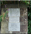
Plaques at Hermitage Park
At the corner of Argyle Street East and Grant Street.
Image: © Thomas Nugent
Taken: 10 Aug 2013
0.04 miles
2
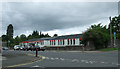
Hermitage Primary School
On Argyle Street East at Grant Street.
Image: © Thomas Nugent
Taken: 10 Aug 2013
0.04 miles
3
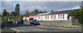
Hermitage Primary School
As with many public buildings in the local authority area, the name at the door is written in English and the Gaelic. Of the two plaques at the corner of Argyll Street East one commemorates the grant of the ground, the other a noted head teacher.
Image: © Tom Sargent
Taken: 5 Oct 2008
0.07 miles
4
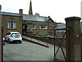
St Joseph's Church Hall
On Grant Street, above East King Street.
Image: © Thomas Nugent
Taken: 10 Aug 2013
0.07 miles
5
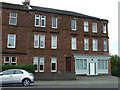
Red sandstone tenement on Argyle Street East
Opposite Hermitage Primary School, with a well maintained retaul unit on the ground floor.
Image: © Thomas Nugent
Taken: 10 Aug 2013
0.08 miles
6
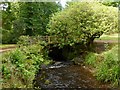
The Milligs Burn
The photograph shows the burn flowing through Image, just upstream of the Image See also Image, which shows the burn flowing into the Firth of Clyde.
Image: © Lairich Rig
Taken: 12 Sep 2012
0.09 miles
8
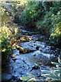
Milligs Burn
Running through Hermitage Park.
Image: © Richard Sutcliffe
Taken: 27 Jan 2022
0.09 miles
9
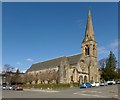
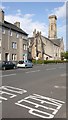
Park Church
The building, which stands on the corner of Charlotte Street and East King Street, is by John Honeyman; the foundation stone was laid in 1862, and the church opened in 1863. The interior was remodelled (1887-88) by William Leiper, the changes including a new staircase.
At one stage of its history, it was known as Park United Free Church. In Helensburgh Cemetery – http://www.geograph.org.uk/snippet/8777 – there is a memorial to its minister Henry Norwell M.A. (1861-1904), who was born at Perth; the memorial was, according to its inscription, "erected by the congregation of Park United Free Church".
Image: © Lairich Rig
Taken: 2 Apr 2013
0.10 miles