
IMAGES TAKEN NEAR TO
ALEXANDRIA, G83 9LU
Introduction
This page details the photographs taken nearby to G83 9LU by members of the Geograph project.
The Geograph project started in 2005 with the aim of publishing, organising and preserving representative images for every square kilometre of Great Britain, Ireland and the Isle of Man.

There are currently over 7.5m images from over14,400 individuals and you can help contribute to the project by visiting https://www.geograph.org.uk
Image Map
Images are licensed for reuse under creativecommons.org/licenses/by-sa/2.0
Notes
- Clicking on the map will re-center to the selected point.
- The higher the marker number, the further away the image location is from the centre of the postcode.
Image Listing (6 Images Found)
Images are licensed for reuse under creativecommons.org/licenses/by-sa/2.0
Image
Details
Distance
1
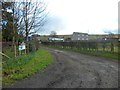
West Auchencarroch
Farm in West Dunbartonshire.
Image: © Stephen Sweeney
Taken: 4 Mar 2012
0.03 miles
2
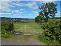
Field gate
The view is from Auchincarroch Road. The field boundary receding from the right-hand side of the gate is marked on the 1:25000 map. The blocks of flats in the left background are in the Haldane.
Image: © Lairich Rig
Taken: 9 Aug 2017
0.11 miles
3
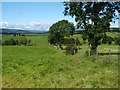
Field boundary
This is one of a pair of views of a field boundary, as seen from Auchincarroch Road; for the other picture, see Image
From the left-hand edge of the photo, and moving towards the centre, the skyline hills are arranged in increasing order of distance; they are: the NE ridge of Gouk Hill (Image), the eastern slopes of Tom na h-Airidh (Image) and of Creachan Mòr (Image), and the dark, distant Cruach a' Bhuic (Image).
Image: © Lairich Rig
Taken: 27 Aug 2010
0.17 miles
4
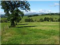
Field boundary
For a similar view, taken from the other side of the boundary, see Image
Right of centre in the present view, Glen Finlas can be seen on the skyline.
Image: © Lairich Rig
Taken: 27 Aug 2010
0.17 miles
5
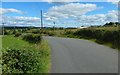
Auchincarroch Road
The road's twisting course here (see the map) takes it past Image, visible not far ahead on the right.
Image: © Lairich Rig
Taken: 9 Aug 2017
0.19 miles
6
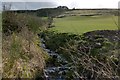
Tributary of the Carrochan Burn
The burn is shown flowing towards Auchincarroch Road, from which the picture was taken. It flows under the road at a point between Image Farm and Image
Image: © Lairich Rig
Taken: 15 Feb 2013
0.21 miles