IMAGES TAKEN NEAR TO
Lochiel Place, ALEXANDRIA, G83 8PR
Introduction
This page details the photographs taken nearby to Lochiel Place, G83 8PR by members of the Geograph project.
The Geograph project started in 2005 with the aim of publishing, organising and preserving representative images for every square kilometre of Great Britain, Ireland and the Isle of Man.

There are currently over 7.5m images from over14,400 individuals and you can help contribute to the project by visiting https://www.geograph.org.uk
Image Map
Images are licensed for reuse under creativecommons.org/licenses/by-sa/2.0
Notes
- Clicking on the map will re-center to the selected point.
- The higher the marker number, the further away the image location is from the centre of the postcode.
Image Listing (76 Images Found)
Images are licensed for reuse under creativecommons.org/licenses/by-sa/2.0
Image
Details
Distance
1
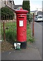
Pillar box, Dalvait Road, Jamestown
Postbox number G83 43D. I have no idea why there is a carton of milk and a packet of crisps sitting beside it.
Image: © Richard Sutcliffe
Taken: 11 May 2019
0.02 miles
2
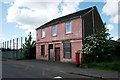
Elmtree House
The house on Dalvait Road dates from 1853 and despite appearances, it is occupied.
Image: © Richard Sutcliffe
Taken: 11 May 2019
0.02 miles
3
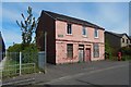
Elmtree House
Another contributor's earlier picture shows the building from a different angle: Image Its year of construction is given there (the figure is carved quite inconspicuously above and to the left of the panel bearing the name of the house). Elmtree House is therefore old enough to appear on the first-edition (1860) OS map of the area, although it is not named on that map.
Image: © Lairich Rig
Taken: 5 May 2020
0.02 miles
4
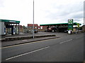
BP filling station Jamestown
BP filling station Jamestown this garage stands on a formal Dam
Image: © Eddie Mackinnon
Taken: 13 May 2007
0.03 miles
5
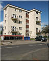
Flats on Davidson Road, Jamestown
Image: © Richard Sutcliffe
Taken: 11 May 2019
0.04 miles
6
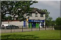
Village Store
A view of the village store in Jamestown, although this shop is called Morning Noon and Night (Co-op) it is known by the locals as Strangs as it is on the site of a smaller store of that name.
Image: © George Rankin
Taken: 9 Jun 2007
0.04 miles
7
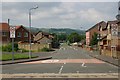
Dalvait Road Junction. Jamestown.
View of Dalvait Road from Main Street Jamestown. Only the Pink House on the right with the Post Box was built pre-1980
Image: © George Rankin
Taken: 9 Jun 2007
0.05 miles
8
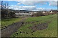
Site of Balloch Shared Campus
The view is from Main Street, opposite the junction with Miller Road.
Image: © Lairich Rig
Taken: 5 Apr 2016
0.05 miles
9
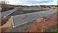
Balloch Shared Campus under construction
The picture was taken at an early stage of the construction process; the official ground-breaking ceremony had taken place a few weeks earlier (see the end-note).
Image: © Lairich Rig
Taken: 1 Jan 2017
0.05 miles