
IMAGES TAKEN NEAR TO
Bramble Hedge Path, ALEXANDRIA, G83 8PH
Introduction
This page details the photographs taken nearby to Bramble Hedge Path, G83 8PH by members of the Geograph project.
The Geograph project started in 2005 with the aim of publishing, organising and preserving representative images for every square kilometre of Great Britain, Ireland and the Isle of Man.

There are currently over 7.5m images from over14,400 individuals and you can help contribute to the project by visiting https://www.geograph.org.uk
Image Map
Images are licensed for reuse under creativecommons.org/licenses/by-sa/2.0
Notes
- Clicking on the map will re-center to the selected point.
- The higher the marker number, the further away the image location is from the centre of the postcode.
Image Listing (88 Images Found)
Images are licensed for reuse under creativecommons.org/licenses/by-sa/2.0
Image
Details
Distance
1
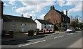
Houses on Main Street, Jamestown
The building on the right contains 'Hairzone' a ladies hair salon.
Image: © Richard Sutcliffe
Taken: 11 May 2019
0.04 miles
2
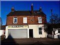
Red Sandstone Building 1879
Vale of Leven Cooperative Soc Ltd built building. This sandstone property was built in 1879 and housed the village shop (The Coop) for over 90 years, after the 1970's it was used by various firms for storage and then lately by a barbers. The holly bush on the right is as old as the building.
Image: © George Rankin
Taken: 27 Apr 2016
0.04 miles
3
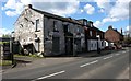
Former Rowantree Tavern, Jamestown
Public house on Main Street, Jamestown, now closed.
Image: © Richard Sutcliffe
Taken: 11 May 2019
0.05 miles
4
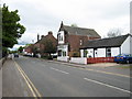
Main Street Jamestown
Jamestown Main street looking south, some of the last original sandstone buildings left in Jamestown Dunbartonshire
Image: © Eddie Mackinnon
Taken: 13 May 2007
0.05 miles
5
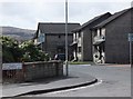
Honeysuckle Lane leading to Bramblehedge Path
Awww, such lovely street-names .... I wanted thatched cottages and cute bunny-wabbits!
Modern housing in the southern part of Jamestown, alongside the A813.
Image: © Barbara Carr
Taken: 21 Apr 2013
0.05 miles
6
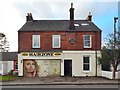
Former co-op building with new mural
For an earlier picture, and for more information about the building, see Image; note the "clasped hands" Co-op symbol on the front wall. See Image for more context.
The mural, by Barry the Cat, is recent.
Image: © Lairich Rig
Taken: 1 Jan 2017
0.05 miles
7
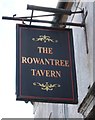
Sign for the Rowantree Tavern
Former public house in Jamestown [https://www.geograph.org.uk/photo/6149384].
Image: © Richard Sutcliffe
Taken: 11 May 2019
0.05 miles
8
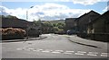
Heatherdale Village, Jamestown
Houses on Honeysuckle Lane.
Image: © Richard Sutcliffe
Taken: 11 May 2019
0.06 miles
9
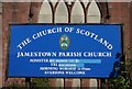
Sign, Jamestown Parish Church
Although the sign looks bright and fresh, the church itself appears to have boarded up windows, suggesting it is not currently in use.
Image: © Richard Sutcliffe
Taken: 11 May 2019
0.06 miles
10
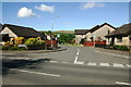
Heatherdale
Looking towards Honeysuckle Lane in Heatherdale, Jamestown, from Main Street, Jamestown, A813.
Image: © George Rankin
Taken: 14 May 2007
0.06 miles