
IMAGES TAKEN NEAR TO
Ballyhennan Crescent, ARROCHAR, G83 7DB
Introduction
This page details the photographs taken nearby to Ballyhennan Crescent, G83 7DB by members of the Geograph project.
The Geograph project started in 2005 with the aim of publishing, organising and preserving representative images for every square kilometre of Great Britain, Ireland and the Isle of Man.

There are currently over 7.5m images from over14,400 individuals and you can help contribute to the project by visiting https://www.geograph.org.uk
Image Map
Images are licensed for reuse under creativecommons.org/licenses/by-sa/2.0
Notes
- Clicking on the map will re-center to the selected point.
- The higher the marker number, the further away the image location is from the centre of the postcode.
Image Listing (59 Images Found)
Images are licensed for reuse under creativecommons.org/licenses/by-sa/2.0
Image
Details
Distance
1
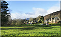
Open green area in Tarbet
The village green in the small village of Tarbet seen from the west on Ballyhennan Crescent. That road curves around the green passing below the houses at the right side of the image.
Image: © Trevor Littlewood
Taken: 31 Jan 2022
0.03 miles
2

Ballyheenan Crescent
A quiet stream and a row of houses off the A83 outside Tarbet.
Image: © Gerald England
Taken: Unknown
0.04 miles
3
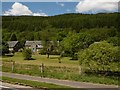
Ballyhennan Crescent, Tarbet
Not far from the railway station, under wooded slopes of Cruach Tairbeirt.
Image: © Richard Webb
Taken: 31 May 2016
0.06 miles
4
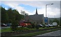
Former Arrochar Free Church now The Black Sheep Arts And Crafts Centre, Ballyhennan, Tarbet, Argyll
Image: © J M Briscoe
Taken: 20 May 2004
0.08 miles
5
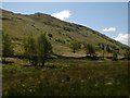
Tarbet Burn
Marshy ground at Tarbet. This is the gap in the hills between Loch Long and Loch Lomond which is used by the railway and Inveraray road (A83).
Image: © Richard Webb
Taken: 31 May 2016
0.09 miles
6
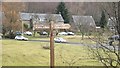
Footpath sign, Tarbet (Dunbartonshire)
Sign at the foot of a water board road, two of the directions are actually the A83. There is a pavement.
Image: © Richard Webb
Taken: 29 Mar 2013
0.10 miles
7
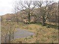
Rough grazing, Tarbet
The road serves a covered reservoir and is signposted as a path. It is linked to a road built in the 1980s roughly beside the railway. Good views of the Cobbler from that road if the weather allows.
Image: © Richard Webb
Taken: 29 Mar 2013
0.10 miles
9
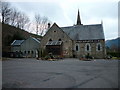
Ballyhennan Restaurant & Bar
A former church in Tarbet.
Image: © Ian S
Taken: 29 Jan 2011
0.12 miles
10
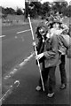
Tarbet - 1971
Tarbet, Old Military Road, A83.
Tarbet is a small village in Argyll and Bute, Scotland.
Traditionally on the northern fringes of the historic County of Dunbarton, it is on the banks of Loch Lomond, and has a pier. It stands on an isthmus where Loch Long and Loch Lomond come close. The village of Arrochar stands at the head of Loch Long, at the other side of the isthmus. Arrochar and Tarbet railway station, on the West Highland Line, stands between them.
Image: © Helmut Zozmann
Taken: 24 Jul 1971
0.12 miles