
IMAGES TAKEN NEAR TO
Angus Street, ALEXANDRIA, G83 0SY
Introduction
This page details the photographs taken nearby to Angus Street, G83 0SY by members of the Geograph project.
The Geograph project started in 2005 with the aim of publishing, organising and preserving representative images for every square kilometre of Great Britain, Ireland and the Isle of Man.

There are currently over 7.5m images from over14,400 individuals and you can help contribute to the project by visiting https://www.geograph.org.uk
Image Map
Images are licensed for reuse under creativecommons.org/licenses/by-sa/2.0
Notes
- Clicking on the map will re-center to the selected point.
- The higher the marker number, the further away the image location is from the centre of the postcode.
Image Listing (153 Images Found)
Images are licensed for reuse under creativecommons.org/licenses/by-sa/2.0
Image
Details
Distance
1

Path beside the Thomas Street flats
We look south along the path beside the blocks of flats which are seen from the opposite direction in Image The River Leven is just out of sight to the left. National Cycle Route 7 runs along this path.
Image: © Alec MacKinnon
Taken: 8 Jul 2025
0.02 miles
2
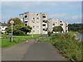
High flats at Riverside
These flats are located in the appropriately-named Riverside area; the nearer two stand on Thomas Street, and the other on Angus Street. The lower buildings at the left-hand edge of the picture are part of St Ronan's Lane.
National Cycle Network route 7 is visible in the foreground.
For a similar view about a year later, see Image
Image: © Lairich Rig
Taken: 21 Sep 2008
0.03 miles
3
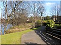
Path crossing the Bonhill Burn
Just after passing by Image, the path crosses above the Bonhill Burn at the point where the burn flows into the River Leven, as shown in this picture. From here, it is only about 200 metres to Image
The name Pappert Burn is also used, perhaps referring more particularly to its upper reaches.
Image: © Lairich Rig
Taken: 25 Feb 2013
0.04 miles
4
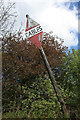
Cables!
Old warning sign for cables on the eastern bank of the River Leven at Bonhill.
Image: © Richard Sutcliffe
Taken: 11 May 2019
0.04 miles
5
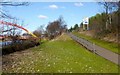
Path to Bonhill Bridge
This is the final section of the route (click on the end-note title for other pictures). The path on the right leads up to the main road, which it joins at the eastern end of Image
Image: © Lairich Rig
Taken: 25 Feb 2013
0.07 miles
6
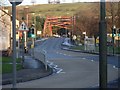
Looking to the Bonhill Bridge
From along Bridge Street, beside the station.
Image: © Stephen Sweeney
Taken: 6 Dec 2008
0.07 miles
7
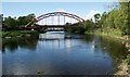
Bonhill Bridge
The current bridge dates from 1986, and replaced an earlier bridge (built in 1898). It carries Bridge Street over the River Leven.
Image: © Richard Sutcliffe
Taken: 11 May 2019
0.07 miles
8
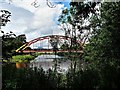
Bonhill Bridge ("Rainbow Bridge") - River Leven
The original Bonhill Bridge (Bawbee Bridge) was built in 1836. It was a chain suspension bridge and was nicknamed "Bawbee Bridge" due to the charge made for a person to cross it.
The second Bonhill Bridge was opened in 1898 and was nicknamed "Whipple Arch". It had a span of 50m and a width of 11.5m. The steel bridge was supported on four red sandstone abutments and carried the usual utilities as well as the tramlines for this new form of transport in the area.
The third Bonhill Bridge was nicknamed “Rainbow Bridge” and the first car drove over it on 28 July 1987. It is made of 284 tonnes of steel, with a span of 60m and width of 14.5m.
Image: © Raibeart MacAoidh
Taken: 19 Jun 2019
0.07 miles
9

E. A. McCarroll and Rossi's Hot Food Take-away
Car sales, servicing and repairs and the Bonhill Fish and Chicken Bar. Bonhill Old Parish Church is behind.
Image: © Richard Sutcliffe
Taken: 11 May 2019
0.07 miles
10

Bonhill Bridge
The New Bridge built 1986 which replaced the Black Bridge built in 1898, replacing a suspension bridge of 1836 built by Admiral Smollett.
Image: © william craig
Taken: 23 Mar 2006
0.07 miles