IMAGES TAKEN NEAR TO
Kirkpatrick Crescent, ALEXANDRIA, G83 0JR
Introduction
This page details the photographs taken nearby to Kirkpatrick Crescent, G83 0JR by members of the Geograph project.
The Geograph project started in 2005 with the aim of publishing, organising and preserving representative images for every square kilometre of Great Britain, Ireland and the Isle of Man.

There are currently over 7.5m images from over14,400 individuals and you can help contribute to the project by visiting https://www.geograph.org.uk
Image Map
Images are licensed for reuse under creativecommons.org/licenses/by-sa/2.0
Notes
- Clicking on the map will re-center to the selected point.
- The higher the marker number, the further away the image location is from the centre of the postcode.
Image Listing (48 Images Found)
Images are licensed for reuse under creativecommons.org/licenses/by-sa/2.0
Image
Details
Distance
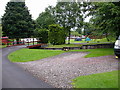
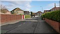
2
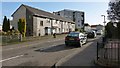
Cameron Drive, Tullichewan
The picture was taken from the junction with Image
Image: © Lairich Rig
Taken: 6 Feb 2013
0.04 miles
3
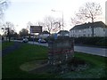
Various signs by Luss Road
Signs welcoming one to Alexandria, wishing one back to Loch Lomond National Park, and directing one to the Loch Lomond Factory Outlets.
Image: © Stephen Sweeney
Taken: 6 Dec 2008
0.05 miles
4
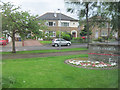
Welcome to Alexandria.
Green and entrance sign. Lomond Drive on left. Taken from B857 Luss Road
Image: © John Firth
Taken: 10 May 2011
0.06 miles
6
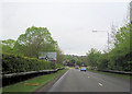
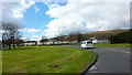
Roundabout at entrance to Loch Lomond Shores
From A811 east
Image: © John Firth
Taken: 11 May 2012
0.08 miles
7
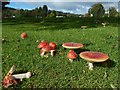
Fly Agaric
The mushrooms are in a mycorrhizal association with (that is, they are associated with the roots of) birch trees that stand here beside a path near Lomond Road in Balloch.
Image: © Lairich Rig
Taken: 21 Sep 2018
0.09 miles
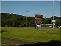
8
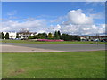
Balloch Roundabout
Balloch Roundabout with heathers in full bloom
Image: © Eddie Mackinnon
Taken: 1 Apr 2006
0.10 miles
9
Lomond Drive, Levenvale
This road is the western entrance into the Levenvale area.
Levenvale and Tullichewan (an area of housing on the other side of Luss Road) together make up much of this grid square, so I have included several representative views (compare Image).
Apart from a few exceptions like Lomond Road and Lomond Drive (shown here), Argyll/Argyle Avenue (named after Image), and Burns Street, all of which are on the edges of Levenvale, many of the streets in this area are named after political figures: see Image for several examples.
Image: © Lairich Rig
Taken: 6 Feb 2013
0.10 miles
10
A811, Balloch
Balloch is a great place for fans of brown signs.
Image: © Richard Webb
Taken: 31 May 2016
0.11 miles