IMAGES TAKEN NEAR TO
Napier Avenue, DUMBARTON, G82 5LY
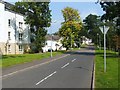
Introduction
This page details the photographs taken nearby to Napier Avenue, G82 5LY by members of the Geograph project.
The Geograph project started in 2005 with the aim of publishing, organising and preserving representative images for every square kilometre of Great Britain, Ireland and the Isle of Man.

There are currently over 7.5m images from over14,400 individuals and you can help contribute to the project by visiting https://www.geograph.org.uk
Image Map
Images are licensed for reuse under creativecommons.org/licenses/by-sa/2.0
Notes
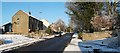
- Clicking on the map will re-center to the selected point.
- The higher the marker number, the further away the image location is from the centre of the postcode.
Image Listing (39 Images Found)
Images are licensed for reuse under creativecommons.org/licenses/by-sa/2.0
Image
Details
Distance
1
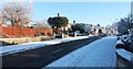
Muirend Road, Cardross
The photograph was taken from the western end of the street, at the junction with Barrs Road.
Image: © Lairich Rig
Taken: 23 Dec 2010
0.11 miles
2
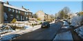
Barrs Road, Cardross
Image: © Lairich Rig
Taken: 23 Dec 2010
0.16 miles
3
Kilmahew Avenue, Cardross
The photograph was taken from the western end of the street, at its junction with Image
Image: © Lairich Rig
Taken: 23 Dec 2010
0.17 miles
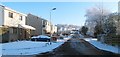
4
Barrs Terrace and Barrs Road, Cardross
Image: © Lairich Rig
Taken: 23 Dec 2010
0.17 miles
5
Barrs Road, Cardross
Ahead, at the entrance gate of a driveway, Kirkton Road branches off to the left. Barrs Road continues to the north, beyond the area of housing: see Image, which also explains the road's name.
Image: © Lairich Rig
Taken: 23 Dec 2010
0.18 miles
6
Barrs Terrace, Cardross
The photograph was taken from the junction with Image
Image: © Lairich Rig
Taken: 23 Dec 2010
0.19 miles
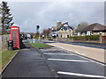
7
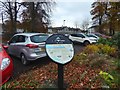
Interpretation panel at Cardross
This is the point where Park Terrace branches off from the Main Road. The panel is, like the one shown in Image, associated with the Clyde Sea Lochs Trail. This one is about the village of Cardross.
Image: © Lairich Rig
Taken: 11 Nov 2016
0.19 miles
8
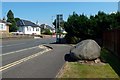
Main Road through Cardross
For the large stone and the plaque on it, see Image, a view in the opposite direction.
Image: © Lairich Rig
Taken: 13 Jul 2018
0.20 miles
9
Braid Drive
This is part of the Fairways housing development in Cardross. The houses had only recently been built when this picture was taken, and they are located beside Cardross Golf Course.
The houses to the left of Braid Drive occupy what was formerly Cardross Park; the park had two lodges on the main road, and a mansion house further to the north.
Image: © Lairich Rig
Taken: 3 Sep 2010
0.20 miles
10
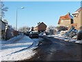
Main Street, Cardross
The A814 through Cardross.
Image: © Barbara Carr
Taken: 18 Apr 2013
0.20 miles