IMAGES TAKEN NEAR TO
Ferry Road, DUMBARTON, G82 5JU
Introduction
This page details the photographs taken nearby to Ferry Road, G82 5JU by members of the Geograph project.
The Geograph project started in 2005 with the aim of publishing, organising and preserving representative images for every square kilometre of Great Britain, Ireland and the Isle of Man.

There are currently over 7.5m images from over14,400 individuals and you can help contribute to the project by visiting https://www.geograph.org.uk
Image Map
Images are licensed for reuse under creativecommons.org/licenses/by-sa/2.0
Notes
- Clicking on the map will re-center to the selected point.
- The higher the marker number, the further away the image location is from the centre of the postcode.
Image Listing (112 Images Found)
Images are licensed for reuse under creativecommons.org/licenses/by-sa/2.0
Image
Details
Distance
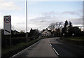
1
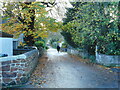
Ferry Road
A dog-walker heads down the road.
Image: © Richard Sutcliffe
Taken: 4 Nov 2022
0.01 miles
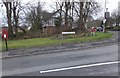
2
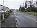
Bainfield Road, Cardross
Housing at the southeastern edge of Cardross village.
Image: © Barbara Carr
Taken: 18 Apr 2013
0.01 miles
4
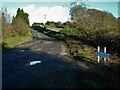
Craigend Road, Cardross
The road leads to Craigend and Walton Farms.
Image: © Richard Sutcliffe
Taken: 4 Nov 2022
0.04 miles
6
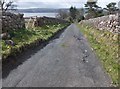
Craigend Road
Walking down the hill from Walton to Cardross, with a view over the Clyde towards Port Glasgow.
Image: © Barbara Carr
Taken: 18 Apr 2013
0.07 miles
7
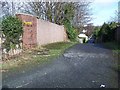
Cardross, Ferry Road Railway over bridge
Image: © william craig
Taken: 17 Feb 2006
0.08 miles
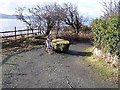
8
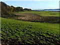
Fields near Westerhill Farm
The farm itself is almost entirely hidden in this view, but is located at the left-hand edge of the most distant clump of trees; for closer views, see Image and Image The high ground to the left consists of Image
Just right of centre, on the near shore of the River Clyde, the mast that is indicated on the map can be seen.
The photo was taken from near the foot of Craigend Road, which is the endpoint of a footpath from Dalmoak to Cardross.
Image: © Lairich Rig
Taken: 16 Oct 2009
0.08 miles