
IMAGES TAKEN NEAR TO
Garshake Road, DUMBARTON, G82 3AE
Introduction
This page details the photographs taken nearby to Garshake Road, G82 3AE by members of the Geograph project.
The Geograph project started in 2005 with the aim of publishing, organising and preserving representative images for every square kilometre of Great Britain, Ireland and the Isle of Man.

There are currently over 7.5m images from over14,400 individuals and you can help contribute to the project by visiting https://www.geograph.org.uk
Image Map
Images are licensed for reuse under creativecommons.org/licenses/by-sa/2.0
Notes
- Clicking on the map will re-center to the selected point.
- The higher the marker number, the further away the image location is from the centre of the postcode.
Image Listing (78 Images Found)
Images are licensed for reuse under creativecommons.org/licenses/by-sa/2.0
Image
Details
Distance
1
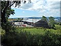
Baxter View under construction
This will be social care housing, by Cornerstone. It is at the top of Garshake Road. Part of the River Clyde is visible in the right background.
See also later pictures: Image and Image
Image: © Lairich Rig
Taken: 11 Jul 2014
0.00 miles
2
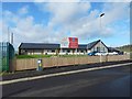
Baxter View
Image: © Lairich Rig
Taken: 22 Feb 2017
0.01 miles
3
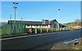
Baxter View
This is newly-built social care housing; compare an earlier view: Image For a less obstructed view, see Image
The road from which the picture was taken is on one of the local council's core paths: Image
Image: © Lairich Rig
Taken: 30 Nov 2014
0.01 miles
4
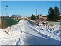
Garshake Water Works
Further ahead, in front of the building that can be seen in the distance, the track divides. The left-hand branch – http://www.geograph.org.uk/photo/2203717 – provides access to Maryland Farm (Image), while the right-hand branch – http://www.geograph.org.uk/photo/2203191 – leads to Image
The part of the track shown in the present photograph passes various buildings of Garshake Water Works. For those on the right, see Image and Image For the building straight ahead, mentioned above, see Image
As for the area to the left of the track, another view (Image) shows that there are large water storage tanks there. Two of these tanks are quite conspicuous from a distance, because they are in the form of domes, 45 and 90 feet in diameter. The water tanks themselves date from the late nineteenth century, and are depicted as circular features on 1:2500 scale OS maps from that period. However, their dome covers, which are made of aluminium, were only added in the mid-1960s.
Most of the derelict eastern buildings also date from the mid-1960s. The northern buildings at the site are more recent additions, but are likewise derelict.
One source of information regarding the history of the water works, up to 1964, is "Royal Burgh of Dumbarton / Garshake Waterworks / Garshake Filter Station – Inauguration of Garshake Filter Station by Provost John Campbell, 21st November, 1964". I have drawn information from that booklet in several of the linked items. The filter station itself is shown in Image
[An aside on a rather different topic: according to an article in a local newspaper in 2010, many people have been caught out by investing money in a land banking scheme in the area near the waterworks. A council spokesman was quoted in the newspaper article as saying that this area has been predominantly identified as greenbelt; this makes housing development unlikely.]
Previous: Image
Next: Image
Image: © Lairich Rig
Taken: 2 Dec 2010
0.02 miles
5

Road leading to the waterworks
The photo was taken from alongside the smaller of two dome-shaped water storage tanks that are located behind the fence to the left of this road.
The waterworks can be seen in the distance, at the end of the road. For pictures of the two domes, see: Image and Image
Previous: Image
Next: Image
Image: © Lairich Rig
Taken: 22 Oct 2008
0.02 miles
6
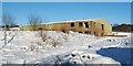
Garshake Water Works: northern building
This is one of the northernmost buildings of Image (it can be seen in the distance in that view). Although the building is now derelict, it was one of the more recent additions to the site, dating to after 1990. By way of contrast, the site's water storage tanks date from the late nineteenth century, although the conspicuous domes that now cover them are later additions: Image
Image: © Lairich Rig
Taken: 2 Dec 2010
0.03 miles
7
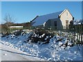
Garshake Water Works: eastern building
Like Image, this is one of a group of buildings on the eastern side of Image For a view from another angle, see Image
The building in the background, on the left, is one of the northern buildings of the site, and is located just to the east of the building shown in Image
Image: © Lairich Rig
Taken: 2 Dec 2010
0.03 miles
8
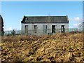
Garshake Water Works: eastern building
The same building appears in the foreground of Image, and is described there. In the present photograph, it is viewed from an adjacent field.
Image: © Lairich Rig
Taken: 27 Feb 2011
0.03 miles
9
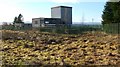
Garshake Water Works: eastern building
The building at the centre of the picture is the same one as appears in Image The present photograph is a view in the opposite direction, and was taken from an adjacent field.
The lower building on the left is what remains of the pressure filter station.
Image: © Lairich Rig
Taken: 27 Feb 2011
0.04 miles
10
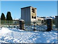
Garshake Water Works: eastern building
This is one of a group of buildings, all now derelict, at the eastern side of Image At the link just cited, the building can be seen on the right-hand side of the track. For a view from a different angle, see Image
Part of the escarpment of the Kilpatrick Hills is visible in the background; compare Image
Image: © Lairich Rig
Taken: 2 Dec 2010
0.04 miles