
IMAGES TAKEN NEAR TO
Stirling Road, DUMBARTON, G82 2SS
Introduction
This page details the photographs taken nearby to Stirling Road, G82 2SS by members of the Geograph project.
The Geograph project started in 2005 with the aim of publishing, organising and preserving representative images for every square kilometre of Great Britain, Ireland and the Isle of Man.

There are currently over 7.5m images from over14,400 individuals and you can help contribute to the project by visiting https://www.geograph.org.uk
Image Map
Images are licensed for reuse under creativecommons.org/licenses/by-sa/2.0
Notes
- Clicking on the map will re-center to the selected point.
- The higher the marker number, the further away the image location is from the centre of the postcode.
Image Listing (103 Images Found)
Images are licensed for reuse under creativecommons.org/licenses/by-sa/2.0
Image
Details
Distance
1
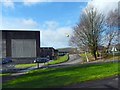
Air Ambulance arriving at Kilmalid
The view is from near the site entrance of the bottling plant at Kilmalid, shortly before noon; I happened to be passing, outbound on an excursion, while a drama was unfolding.
A number of emergency vehicles had already arrived, and they were soon augmented by the Scottish Ambulance Service helicopter (registration G-SASS) that can be seen here; it had just passed overhead.
Later in the day, when I was submitting this picture, news reports stated that an industrial accident had occurred, and that, although there had been no fatalities, a man who had been trapped under machinery was taken to hospital to be treated for his injuries.
Image: © Lairich Rig
Taken: 22 Feb 2017
0.03 miles
2
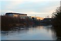
Bottling and blending plant
The lettering on the building is shown illuminated by the sun shortly before sunset. The view is from the neck of Dalquhurn Point: http://www.geograph.org.uk/snippet/14135
Image: © Lairich Rig
Taken: 18 Dec 2017
0.03 miles
3
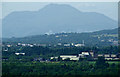
Ben Lomond
If a child was to draw a mountain, it would probably look like this.
Viewed along a very green looking Vale of Leven from the top of Dumbarton Rock.
Image: © Thomas Nugent
Taken: 12 Jul 2013
0.04 miles
5
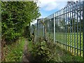
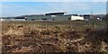
Path beside the Kilmalid works
The view is from further along the path that is shown in Image The 1:25000 maps shows some of the structures that can be seen on the right. For a view from further ahead, see Image
Image: © Lairich Rig
Taken: 23 Apr 2017
0.08 miles
6
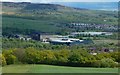
Kilmalid bottling and blending plant
The older (back) and recent (front) parts of the plant are at the centre of the picture. The older part has retained its Ballantine's logo. This is a distant view, from almost a mile off; it is difficult to obtain a good view of the site as a whole from nearby, but click on the end-note title for various closer views.
The areas of housing are (near right) the newer parts of Dalquhurn and (right background) Bellsmyre, with part of the Long Crags forming the backdrop. A large industrial building on the right, directly between the two areas of housing, is not part of the Kilmalid plant, but is the Image
Two domes seen indistinctly in the distance at the far right are part of Garshake Water Works: https://www.geograph.org.uk/snippet/4892
Image: © Lairich Rig
Taken: 8 May 2020
0.08 miles
7
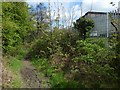
Path beside the Kilmalid works
The view is from further along the path shown in Image This part of it is opposite the tip of Dalquhurn Point.
For a view from further ahead, see Image
Image: © Lairich Rig
Taken: 23 Apr 2017
0.08 miles
8
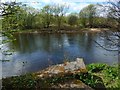
The River Leven at Kilmalid
The view is from near a Image; in the foreground is an outflow just like the one shown in Image On the other side of the Leven is the tip of Dalquhurn Point.
Image: © Lairich Rig
Taken: 23 Apr 2017
0.10 miles
9
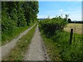
Farm track at Kilmalid
This is the opposite view to Image, and it was taken from beside Image Followed in this direction, it leads to Stirling Road, which it meets near the Lion's Gate: Image
Image: © Lairich Rig
Taken: 25 May 2018
0.10 miles
10
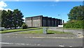
Kilmalid Bottling and Blending Plant
At the time, this was the main entrance to the site. A new two-way access road, with a new gatehouse, was to be created later. It would leave the existing road at Image, where there is currently a gate opening onto an open space with grass and trees: Image
Image: © Lairich Rig
Taken: 29 Aug 2020
0.10 miles