IMAGES TAKEN NEAR TO
Dumbuck Gardens, DUMBARTON, G82 1DA
Introduction
This page details the photographs taken nearby to Dumbuck Gardens, G82 1DA by members of the Geograph project.
The Geograph project started in 2005 with the aim of publishing, organising and preserving representative images for every square kilometre of Great Britain, Ireland and the Isle of Man.

There are currently over 7.5m images from over14,400 individuals and you can help contribute to the project by visiting https://www.geograph.org.uk
Image Map
Images are licensed for reuse under creativecommons.org/licenses/by-sa/2.0
Notes
- Clicking on the map will re-center to the selected point.
- The higher the marker number, the further away the image location is from the centre of the postcode.
Image Listing (43 Images Found)
Images are licensed for reuse under creativecommons.org/licenses/by-sa/2.0
Image
Details
Distance
1

Glasgow Road
The A814, looking east at Dumbuck Gardens.
Image: © Thomas Nugent
Taken: 27 Apr 2015
0.03 miles
3
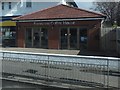
Benvenuti Coffee House
On the A814 on the outskirts of Dumbarton.
Image: © Barbara Carr
Taken: 18 Apr 2013
0.08 miles
4
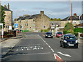
Traffic Lights on Glasgow Road
The A814 diverges from the A82 close to the Dumbuck Quarry near Milton. It heads west through Dumbuck, and the eastern suburbs of Dumbarton as Glasgow Road.
Image: © David Dixon
Taken: 26 Sep 2019
0.09 miles
5
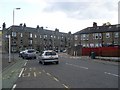
Greenhead Road at Glasgow Road, Dumbarton
Image: © Stephen Sweeney
Taken: 31 May 2008
0.10 miles
6
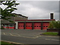
Dumbarton Fire Station
On Castlegreen St.
Image: © Stephen Sweeney
Taken: 11 May 2007
0.11 miles
7

Former North British Railway line
Now a busy foot and cycle path. Looking east from the Greenhead Road bridge.
Image: © Thomas Nugent
Taken: 27 Apr 2015
0.13 miles
8
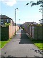
Lane leading to Dumbuck Crescent
The photograph was taken from the cycle route (NCN Route 7), specifically, the part shown in Image
The photograph really shows two short lanes, seen end-to-end; the nearer leads to Dumbuck Crescent. From the far side of that road, another such lane leads to Glasgow Road; the building that lies directly ahead, in the distance, is on the far side of Glasgow Road.
Image: © Lairich Rig
Taken: 10 Jun 2011
0.14 miles
9
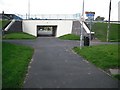
Underpass, Greenhead Road
Used by the Glasgow to Balloch cycle path, NCN7.
Image: © Richard Webb
Taken: 1 Sep 2009
0.14 miles