IMAGES TAKEN NEAR TO
Montrose Street, CLYDEBANK, G81 2PA
Introduction
This page details the photographs taken nearby to Montrose Street, G81 2PA by members of the Geograph project.
The Geograph project started in 2005 with the aim of publishing, organising and preserving representative images for every square kilometre of Great Britain, Ireland and the Isle of Man.

There are currently over 7.5m images from over14,400 individuals and you can help contribute to the project by visiting https://www.geograph.org.uk
Image Map
Images are licensed for reuse under creativecommons.org/licenses/by-sa/2.0
Notes
- Clicking on the map will re-center to the selected point.
- The higher the marker number, the further away the image location is from the centre of the postcode.
Image Listing (130 Images Found)
Images are licensed for reuse under creativecommons.org/licenses/by-sa/2.0
Image
Details
Distance
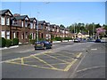
2
The back of Montrose Street
Looking from Melfort Park onto the backs of houses on Montrose Street, behind which is the police station.
Image: © Richard Sutcliffe
Taken: 20 Jul 2023
0.01 miles
3
The back of Montrose Street
Looking from Melfort Park onto the backs of houses on Montrose Street.
Image: © Richard Sutcliffe
Taken: 20 Jul 2023
0.01 miles
4
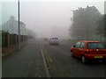
Foggy morning on Montrose Street
The end of the road isn't even visible!
Image: © Stephen Sweeney
Taken: 24 Oct 2007
0.02 miles
5
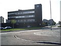
Clydebank Police Station
On Montrose Street.
Image: © Stephen Sweeney
Taken: 6 May 2008
0.04 miles
6
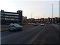
Montrose Street, Clydebank
Looking past the town's police station.
Image: © Stephen Sweeney
Taken: 15 Feb 2008
0.04 miles
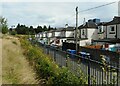
7
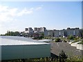
View across Clydebank from Argyll Road
At the railway bridge.
Image: © Stephen Sweeney
Taken: 5 May 2008
0.04 miles
8
Edge of the park
The edge of Melfort Park at Cambridge Avenue, Clydebank.
Image: © Richard Sutcliffe
Taken: 20 Jul 2023
0.06 miles
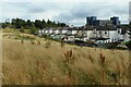
9
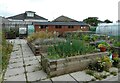
Community garden, Melfort Park
Various crops growing in raised beds in the community garden at Melfort Park. The area is behind a security fence, but was accessed during a bioblitz of the park.
Image: © Richard Sutcliffe
Taken: 20 Jul 2023
0.06 miles
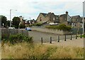
10
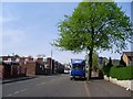
Clarence Street, Clydebank
Often used by drivers as a short cut between Drumry Road and the town centre.
Image: © Stephen Sweeney
Taken: 6 May 2008
0.06 miles