
IMAGES TAKEN NEAR TO
Hillside Road, GLASGOW, G78 3EN
Introduction
This page details the photographs taken nearby to Hillside Road, G78 3EN by members of the Geograph project.
The Geograph project started in 2005 with the aim of publishing, organising and preserving representative images for every square kilometre of Great Britain, Ireland and the Isle of Man.

There are currently over 7.5m images from over14,400 individuals and you can help contribute to the project by visiting https://www.geograph.org.uk
Image Map
Images are licensed for reuse under creativecommons.org/licenses/by-sa/2.0
Notes
- Clicking on the map will re-center to the selected point.
- The higher the marker number, the further away the image location is from the centre of the postcode.
Image Listing (55 Images Found)
Images are licensed for reuse under creativecommons.org/licenses/by-sa/2.0
Image
Details
Distance

2
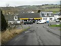
Licensed grocer
Premier, licensed grocer, on Main Street Neilston.
Image: © Richard Sutcliffe
Taken: 23 Feb 2023
0.10 miles
4

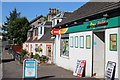
Neilston Railway Station
Neilston was once a station on the Glasgow to Ardrossan line. When the Glasgow electric "Blue Trains" were introduced in 1962 the line was electrified only this far and Neilston became the terminus of the line.
Image: © John Allan
Taken: 2 Aug 2006
0.15 miles
6
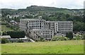
Crofthead Mill, Neilston
Known locally as Neilston Mill, it is a Category B listed building [http://portal.historicenvironment.scot/designation/LB18959]. The earliest existing parts date from 1858, although the original mill was founded in 1792. It closed in 1992.
Neilston Pad is in the distance.
Image: © Richard Sutcliffe
Taken: 14 Jul 2017
0.17 miles
7
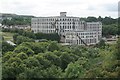
Crofthead Mill, Neilston
Known locally as Neilston Mill, it is a Category B listed building [http://portal.historicenvironment.scot/designation/LB18959]. The earliest existing parts date from 1858, although the original mill was founded in 1792. It closed in 1992.
Image: © Richard Sutcliffe
Taken: 14 Jul 2017
0.17 miles
9

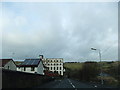
The end of the line
This is the very end of the Glasgow to Neilston railway line. Originally the line continued past Neilston to Ardrossan, but the line beyond Neilston closed in 1962. This headshunt just southwest of the station allows trains from Glasgow to change tracks before travelling back there.
Image: © Richard Sutcliffe
Taken: 23 Feb 2023
0.17 miles
10
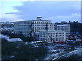
Crofthead Mill
This large former cotton mill dominates many views of Neilston from the Fereneze Hills despite its valley location.
Image: © Mark Nightingale
Taken: 4 Mar 2009
0.17 miles