IMAGES TAKEN NEAR TO
Muirhead Road, GLASGOW, G78 3BY
Introduction
This page details the photographs taken nearby to Muirhead Road, G78 3BY by members of the Geograph project.
The Geograph project started in 2005 with the aim of publishing, organising and preserving representative images for every square kilometre of Great Britain, Ireland and the Isle of Man.

There are currently over 7.5m images from over14,400 individuals and you can help contribute to the project by visiting https://www.geograph.org.uk
Image Map
Images are licensed for reuse under creativecommons.org/licenses/by-sa/2.0
Notes
- Clicking on the map will re-center to the selected point.
- The higher the marker number, the further away the image location is from the centre of the postcode.
Image Listing (10 Images Found)
Images are licensed for reuse under creativecommons.org/licenses/by-sa/2.0
Image
Details
Distance
1
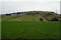
Braeface Farm
On the east side of Howcraigs Hill.
Image: © Richard Sutcliffe
Taken: 23 Feb 2023
0.06 miles
2
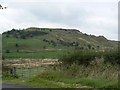
Howcraigs Hill
Seen from near Jaapston.
Image: © James Allan
Taken: 19 Sep 2009
0.12 miles
3
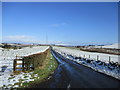
Looking north-east from Braeface road-end
A similar view to Image, with a more wintry flavour.
Image: © Alan O'Dowd
Taken: 27 Feb 2020
0.15 miles
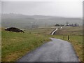
5
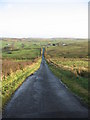
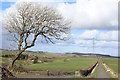
Straight road.
Farm at end of road is Aboon the Brae. Which I reckon means below the hillside.
Image: © wfmillar
Taken: 11 Nov 2006
0.16 miles
6
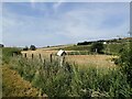
Farmland between Uplawmoor and Neilston
Taken from the side of the minor road that gives a back way between Uplawmoor and Neilston, this view looks over newly cut fields below Braeface farm.
Image: © Alec MacKinnon
Taken: 23 Jul 2021
0.16 miles
8
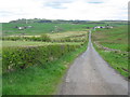
Road leading to Aboon the Brae
The Neilston Pad is the higher land to the left of the photograph.
Image: © G Laird
Taken: 2 May 2014
0.19 miles
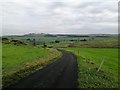
9
Road on Howcraigs Hill
Utterly miserable weather.
Image: © Richard Webb
Taken: 5 Mar 2023
0.22 miles
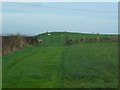
10
At the top of the brae
As marked on the map, the road above the farm called Aboon the Brae climbs steeply as one follows the road towards Uplawmoor. Only the upper part of this steep brae is shown here, however, with the farm further away.
Image: © Alec MacKinnon
Taken: 15 Sep 2020
0.22 miles