IMAGES TAKEN NEAR TO
Crebar Drive, GLASGOW, G78 2DE
Introduction
This page details the photographs taken nearby to Crebar Drive, G78 2DE by members of the Geograph project.
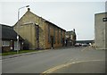
The Geograph project started in 2005 with the aim of publishing, organising and preserving representative images for every square kilometre of Great Britain, Ireland and the Isle of Man.

There are currently over 7.5m images from over14,400 individuals and you can help contribute to the project by visiting https://www.geograph.org.uk
Image Map
Images are licensed for reuse under creativecommons.org/licenses/by-sa/2.0
Notes
- Clicking on the map will re-center to the selected point.
- The higher the marker number, the further away the image location is from the centre of the postcode.
Image Listing (25 Images Found)
Images are licensed for reuse under creativecommons.org/licenses/by-sa/2.0
Image
Details
Distance
2
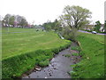
Aurs Burn in Auchenback Community Park
Small park in the heart of Auchenback, Barrhead.
Image: © G Laird
Taken: 30 Apr 2014
0.15 miles
3
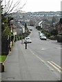
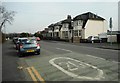
View southeast across Auchenback
From Cloth Street.
Image: © Stephen Sweeney
Taken: 6 Jan 2010
0.21 miles
4
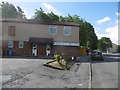
Arthurlie FC Social Club
On Ralston Road.
Image: © Richard Webb
Taken: 25 Jun 2016
0.21 miles
5
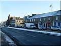
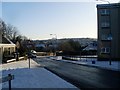
Shops along Main Street
In Barrhead town centre.
Image: © Stephen Sweeney
Taken: 6 Jan 2010
0.21 miles
7
St Andrew's Parish Church, Barrhead
A Category B listed church on Main Street, built as the Free Church in 1846.
Image: © Richard Sutcliffe
Taken: 24 Mar 2017
0.22 miles
8
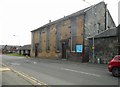
United Reformed Church, Barrhead
On Arthurlie Street.
Image: © Richard Sutcliffe
Taken: 24 Mar 2017
0.22 miles
9
United Reformed Church, Barrhead
On Arthurlie Street.
Image: © Richard Sutcliffe
Taken: 24 Mar 2017
0.22 miles
10
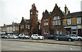
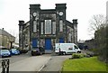
Burgh Court Hall and Burgh Chambers, Main Street, Barrhead
The two buildings are individually listed as Category C, but are a Category B group together. They were built as a pair in 1902, when Barrhead was a police burgh. The Burgh Court Hall (on the left) was the Barrhead Municipal Chambers and Burgh Court, the offices of the town council. Later it became Barrhead Arts and Heritage Centre and housed the Barrhead Community Museum from 1994-2000 when it closed to the public. It still has 'Museum' signs outside. It is currently occupied by Enable Scotland and the building is still known as the Barrhead Arts and Heritage Centre.
Image: © Richard Sutcliffe
Taken: 24 Mar 2017
0.22 miles