IMAGES TAKEN NEAR TO
Kintyre Crescent, GLASGOW, G77 6SR
Introduction
This page details the photographs taken nearby to Kintyre Crescent, G77 6SR by members of the Geograph project.
The Geograph project started in 2005 with the aim of publishing, organising and preserving representative images for every square kilometre of Great Britain, Ireland and the Isle of Man.

There are currently over 7.5m images from over14,400 individuals and you can help contribute to the project by visiting https://www.geograph.org.uk
Image Map
Images are licensed for reuse under creativecommons.org/licenses/by-sa/2.0
Notes
- Clicking on the map will re-center to the selected point.
- The higher the marker number, the further away the image location is from the centre of the postcode.
Image Listing (9 Images Found)
Images are licensed for reuse under creativecommons.org/licenses/by-sa/2.0
Image
Details
Distance
1
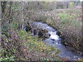
Waterfall on Capelrig Burn
In a small woodland area just off Crookfur Road, Newton Mearns.
Image: © G Laird
Taken: 12 Nov 2013
0.16 miles
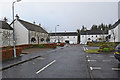
3
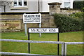
Entrance to Meadow Rise, Newton Mearns
Entrance signs at the Meadow Rise housing estate, Newton Mearns
Image: © Jerzy Morkis
Taken: 3 Jan 2020
0.18 miles
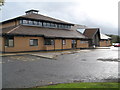
4
Newton Mearns Baptist Church
Greenfarm Road, Newton Mearns
Image: © G McK
Taken: 3 Jul 2005
0.19 miles
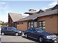
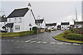
5
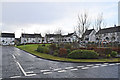
Meadow Rise, Newton Mearns
Meadow Rise housing estate, Newton Mearns
Image: © Jerzy Morkis
Taken: 3 Jan 2020
0.21 miles
7
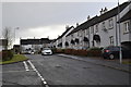
Meadow Rise, Newton Mearns
Housing estate by St Cadoc's primary school, Newton Mearns
Image: © Jerzy Morkis
Taken: 3 Jan 2020
0.24 miles
8
Meadow Rise, Newton Mearns
Meadow Rise housing estate, Newton Mearns
Image: © Jerzy Morkis
Taken: 3 Jan 2020
0.25 miles
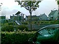
9
Play park, Meadow Rise, Newton Mearns
Children's small playpark in the centre of the Meadow Rise housing estate, Newton Mearns
Image: © Jerzy Morkis
Taken: 3 Jan 2020
0.25 miles