IMAGES TAKEN NEAR TO
Dodside Road, GLASGOW, G77 6PZ
Introduction
This page details the photographs taken nearby to Dodside Road, G77 6PZ by members of the Geograph project.
The Geograph project started in 2005 with the aim of publishing, organising and preserving representative images for every square kilometre of Great Britain, Ireland and the Isle of Man.

There are currently over 7.5m images from over14,400 individuals and you can help contribute to the project by visiting https://www.geograph.org.uk
Image Map
Images are licensed for reuse under creativecommons.org/licenses/by-sa/2.0
Notes
- Clicking on the map will re-center to the selected point.
- The higher the marker number, the further away the image location is from the centre of the postcode.
Image Listing (14 Images Found)
Images are licensed for reuse under creativecommons.org/licenses/by-sa/2.0
Image
Details
Distance
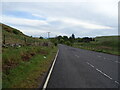
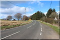
2
The B769
Here we are close to Dod Hill.
Image: © Malcolm Neal
Taken: 20 Mar 2022
0.05 miles
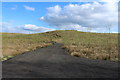
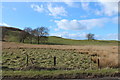
5
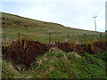
Grazing beside the B769
At the foot of Dod Hill.
Image: © JThomas
Taken: 24 May 2021
0.08 miles
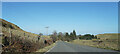
6
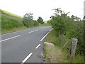
B769, Dodside
The road passes Dod Hill.
Image: © Richard Webb
Taken: 25 Jun 2016
0.09 miles
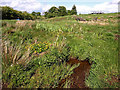
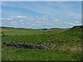
9
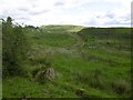
Rough pasture near Dodside
Off the B769.
Image: © Richard Webb
Taken: 25 Jun 2016
0.12 miles