IMAGES TAKEN NEAR TO
Edenhall Grove, GLASGOW, G77 5TS
Introduction
This page details the photographs taken nearby to Edenhall Grove, G77 5TS by members of the Geograph project.
The Geograph project started in 2005 with the aim of publishing, organising and preserving representative images for every square kilometre of Great Britain, Ireland and the Isle of Man.

There are currently over 7.5m images from over14,400 individuals and you can help contribute to the project by visiting https://www.geograph.org.uk
Image Map
Images are licensed for reuse under creativecommons.org/licenses/by-sa/2.0
Notes
- Clicking on the map will re-center to the selected point.
- The higher the marker number, the further away the image location is from the centre of the postcode.
Image Listing (30 Images Found)
Images are licensed for reuse under creativecommons.org/licenses/by-sa/2.0
Image
Details
Distance
1
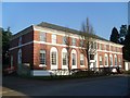
Cresswell Place, Newton Mearns
Plush residential area south of Glasgow.
Image: © Stephen Sweeney
Taken: 12 Apr 2010
0.08 miles
2
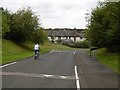
Mearnskirk Road
A route into the Kirklands housing estate, built on the site of Mearnskirk Hospital. Mearnskirk was built for children with tuberculosis and opened in what was then a rural site in 1932. Previously this was the policies of Southfield Estate and neighbouring farms. Southfield House was at NS53685452
Image: © Richard Webb
Taken: 28 Aug 2016
0.09 miles
3
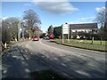
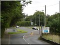
Junction of Mearnskirk Road and Keltie Bridge
In Newton Mearns.
Image: © Stephen Sweeney
Taken: 12 Apr 2010
0.11 miles
4
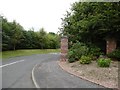
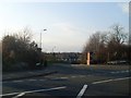
Entrance to Kirklands
A 1990s development of the Mearnskirk Hospital site. The "gate" pillars are now frost shattered and looking rather battered.
Image: © Richard Webb
Taken: 28 Aug 2016
0.12 miles
5
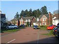
Houses in Victoria Square
The area of Newton Mearns is certainly one of the more plush suburbs of Glasgow.
Image: © Stephen Sweeney
Taken: 12 Apr 2010
0.12 miles
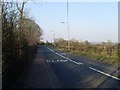
6
Mearns Road
The junction is with Humbie Road - the roundabout has been offset.
Image: © Richard Webb
Taken: 28 Aug 2016
0.13 miles
7
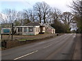
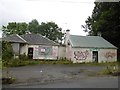
Derelict former restaurant
This building beside Mearns Road used to be a rather good Chinese restaurant that attracted business from a wide area: Newton Mearns, Clarkston, Busby etc. It has been derelict for several years.
Image: © Alec MacKinnon
Taken: 14 Apr 2017
0.13 miles
8
Derelict building, Mearns Road
Former licensed premises according to the estate agent's sign.
Image: © Richard Webb
Taken: 28 Aug 2016
0.14 miles
9
Mearns Road, Newton Mearns
Just entering the Newton Mearns area from the A726.
Image: © Stephen Sweeney
Taken: 12 Apr 2010
0.15 miles