IMAGES TAKEN NEAR TO
Cresswell Grove, GLASGOW, G77 5FX
Introduction
This page details the photographs taken nearby to Cresswell Grove, G77 5FX by members of the Geograph project.
The Geograph project started in 2005 with the aim of publishing, organising and preserving representative images for every square kilometre of Great Britain, Ireland and the Isle of Man.

There are currently over 7.5m images from over14,400 individuals and you can help contribute to the project by visiting https://www.geograph.org.uk
Image Map
Images are licensed for reuse under creativecommons.org/licenses/by-sa/2.0
Notes
- Clicking on the map will re-center to the selected point.
- The higher the marker number, the further away the image location is from the centre of the postcode.
Image Listing (12 Images Found)
Images are licensed for reuse under creativecommons.org/licenses/by-sa/2.0
Image
Details
Distance
1
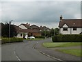
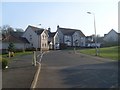
Newton Grove
The 1950s Image has been extended - 1990s by the look of things.
Image: © Richard Webb
Taken: 28 Aug 2016
0.07 miles
2
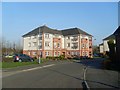
Flats on Kirklands Drive, Newton Mearns
Image: © Stephen Sweeney
Taken: 12 Apr 2010
0.11 miles
3
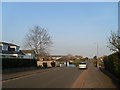
Paidmyre Road
East view from the top of Langrig Road.
Image: © Stephen Sweeney
Taken: 12 Apr 2010
0.11 miles
4
Kirklands Drive
A 1990s housing development on the site of the Mearnskirk Hospital. Mearnskirk was built for children with tuberculosis and opened in what was then a rural site in 1932. Previously this was the policies of Southfield Estate and neighbouring farms. Southfield House was at Image
Image: © Richard Webb
Taken: 28 Aug 2016
0.13 miles
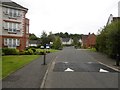
5
Kirklands Drive
Residential area in the south of Newton Mearns.
Image: © Stephen Sweeney
Taken: 12 Apr 2010
0.15 miles
6
Newton Grove
This residential street is marked as under construction on the 1959 1:25,000 map. It was then on the edge of the village.
Image: © Richard Webb
Taken: 28 Aug 2016
0.17 miles
7
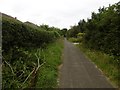
Langrig Road
This old road, now a tarred path was once the driveway to Langrig House. It is now a connecting route between the new houses of Newton Grove and Kirklands.
Image: © Richard Webb
Taken: 28 Aug 2016
0.18 miles
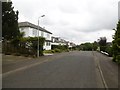
8
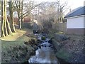
Burn in Newton Mearns
Seen from Kirklands Road.
Image: © Stephen Sweeney
Taken: 12 Apr 2010
0.18 miles
9
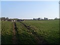
Fields south of Newton Mearns
Seen from the bottom of Langrig Road.
Image: © Stephen Sweeney
Taken: 12 Apr 2010
0.21 miles
10
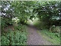
Former road to Langrig
One of a pair of roads which served the probable farm at Langrig. Now a path.
Image: © Richard Webb
Taken: 28 Aug 2016
0.22 miles