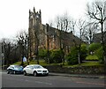
IMAGES TAKEN NEAR TO
Arthur Place, Eaglesham Road, GLASGOW, G76 7DQ

Introduction

This page details the photographs taken nearby to Arthur Place, Eaglesham Road, G76 7DQ by members of the Geograph project.

The Geograph project started in 2005 with the aim of publishing, organising and preserving representative images for every square kilometre of Great Britain, Ireland and the Isle of Man.

There are currently over 7.5m images from over14,400 individuals and you can help contribute to the project by visiting https://www.geograph.org.uk

Image Map


Images are licensed for reuse under creativecommons.org/licenses/by-sa/2.0
Notes
  • Clicking on the map will re-center to the selected point.
  • The higher the marker number, the further away the image location is from the centre of the postcode.

Image Listing (22 Images Found)

Images are licensed for reuse under creativecommons.org/licenses/by-sa/2.0
  • ...
Image
Details
Distance
1
The junction of Greenwood Rd and Eaglesham Rd
Image: © G McK Taken: 24 Dec 2005
0.04 miles
2
Busby Road, Clarkston on Christmas Eve
Note the change of road number on the sign. This was changed when the new Southern Orbital road was opened.
Image: © G McK Taken: 24 Dec 2005
0.04 miles
3
Shops on Eaglesham Road
A variety of shops including the post office (soon to be a Spar) on the B767, Eaglesham Road.
Image: © Richard Sutcliffe Taken: 15 Feb 2023
0.05 miles
4
Greenbank Garden
Water feature in Greenbank Garden, Clarkston. The Garden is a National Trust for Scotland property.
Image: © David McMumm Taken: 9 Jun 2003
0.07 miles
5
Tower of Greenbank Parish Church
From Cartsbridge Road.
Image: © Stephen Sweeney Taken: 13 Jun 2009
0.08 miles
6
Busby Road at Sheddens Roundabout
The A727 continues to the left, while the B727 is to the right.
Image: © Richard Sutcliffe Taken: 17 Dec 2019
0.08 miles
7
Greenbank Parish Church, Clarkston
An Autumn view of the Church Tower and Clock.
Image: © John McLeish Taken: 6 Oct 2006
0.08 miles
8
Greenbank Parish Church
Designed by architect William Gardner Rowan, of McKissack and Rowan and dated 1884. It is Category C listed http://portal.historicenvironment.scot/designation/LB52459.
Image: © Richard Sutcliffe Taken: 15 Feb 2023
0.09 miles
9
Terraced houses, Busby Road
Beside Sheddens Roundabout.
Image: © Richard Sutcliffe Taken: 17 Dec 2019
0.09 miles
10
Greenbank Parish Church
On Eaglesham Road (B767) opposite the intersection with Cartsbridge Road.
Image: © G Laird Taken: 1 Jan 2013
0.09 miles
  • ...