IMAGES TAKEN NEAR TO
Ionia Grove, GLASGOW, G75 9FN
Introduction
This page details the photographs taken nearby to Ionia Grove, G75 9FN by members of the Geograph project.
The Geograph project started in 2005 with the aim of publishing, organising and preserving representative images for every square kilometre of Great Britain, Ireland and the Isle of Man.

There are currently over 7.5m images from over14,400 individuals and you can help contribute to the project by visiting https://www.geograph.org.uk
Image Map
Images are licensed for reuse under creativecommons.org/licenses/by-sa/2.0
Notes
- Clicking on the map will re-center to the selected point.
- The higher the marker number, the further away the image location is from the centre of the postcode.
Image Listing (14 Images Found)
Images are licensed for reuse under creativecommons.org/licenses/by-sa/2.0
Image
Details
Distance
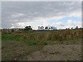
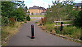
1
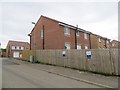
Kenton Drive
New houses, East Kilbride.
Image: © Richard Webb
Taken: 1 Aug 2014
0.01 miles
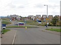
2
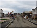
Applegate Drive
Building site on the edge of East Kilbride.
Image: © Richard Webb
Taken: 1 Aug 2014
0.07 miles
3
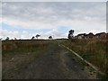
Newlands, East Kilbride
Land being developed for housing.
Image: © Richard Webb
Taken: 1 Aug 2014
0.11 miles
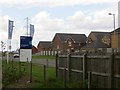
4
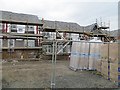
House building, Lindsayfield Road
Expansion of East Kilbride.
Image: © Richard Webb
Taken: 1 Aug 2014
0.16 miles
5
Building site, Newlands
Building on fields on the edge of East Kilbride.
Image: © Richard Webb
Taken: 1 Aug 2014
0.16 miles
6
Lindsayfield Road
Taken during a time of house building inside Jackton Road.
Image: © Richard Webb
Taken: 1 Aug 2014
0.18 miles
7
Lindsayfield Road
New houses on the current edge of East Kilbride. View from the recently rural Jackton Road.
Image: © Richard Webb
Taken: 1 Aug 2014
0.19 miles
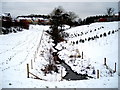
10
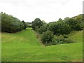
Burn, Lindsayfield
A green space amongst the new houses.
Image: © Richard Webb
Taken: 1 Aug 2014
0.21 miles