IMAGES TAKEN NEAR TO
Catbells Drive, G75 7AF
Introduction
This page details the photographs taken nearby to Catbells Drive, G75 7AF by members of the Geograph project.
The Geograph project started in 2005 with the aim of publishing, organising and preserving representative images for every square kilometre of Great Britain, Ireland and the Isle of Man.

There are currently over 7.5m images from over14,400 individuals and you can help contribute to the project by visiting https://www.geograph.org.uk
Image Map
Images are licensed for reuse under creativecommons.org/licenses/by-sa/2.0
Notes
- Clicking on the map will re-center to the selected point.
- The higher the marker number, the further away the image location is from the centre of the postcode.
Image Listing (16 Images Found)
Images are licensed for reuse under creativecommons.org/licenses/by-sa/2.0
Image
Details
Distance
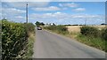
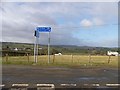
2
Approaching Dunrobin on Newlands Road
Image: © Stephen Sweeney
Taken: 17 Jan 2012
0.08 miles
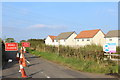
8
Junction of Newlands Road and Jackton Road
Image: © Elliott Simpson
Taken: 23 Apr 2013
0.17 miles
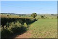
9
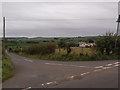
Road to North and South Allerton
This is the junction of the private road to North Allerton and South Allerton farmhouses with Jackton Road.
Image: © Alec MacKinnon
Taken: 1 Oct 2018
0.18 miles