
IMAGES TAKEN NEAR TO
East Kilbride, GLASGOW, G74 4NU
Introduction
This page details the photographs taken nearby to G74 4NU by members of the Geograph project.
The Geograph project started in 2005 with the aim of publishing, organising and preserving representative images for every square kilometre of Great Britain, Ireland and the Isle of Man.

There are currently over 7.5m images from over14,400 individuals and you can help contribute to the project by visiting https://www.geograph.org.uk
Image Map
Images are licensed for reuse under creativecommons.org/licenses/by-sa/2.0
Notes
- Clicking on the map will re-center to the selected point.
- The higher the marker number, the further away the image location is from the centre of the postcode.
Image Listing (10 Images Found)
Images are licensed for reuse under creativecommons.org/licenses/by-sa/2.0
Image
Details
Distance
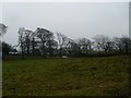
2
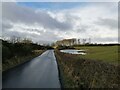
Minor road north of East Kilbride
The road passes through farmland just beyond the northern edge of East Kilbride.
Image: © Alec MacKinnon
Taken: 12 Mar 2021
0.10 miles
3

Wood beside minor road junction
The wee wood, seen from the south-west, sits beside the junction where the road that has come from the Cathkin Braes direction meets Cairnmuir Road.
Image: © Alec MacKinnon
Taken: 26 Feb 2021
0.11 miles
4
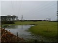
Flooding by Cairnmuir Road
Near the electricity substation north of Rogerton.
Image: © Stephen Sweeney
Taken: 26 Jan 2010
0.11 miles
5

Electricity substation
North of Rogerton.
Image: © Stephen Sweeney
Taken: 26 Jan 2010
0.14 miles
6

East Kilbride GSP (Grid Supply Point)
Linking (via appropriate transformers) national grid lines and local 11KV power lines.
Image: © Gordon Brown
Taken: 14 Nov 2019
0.18 miles
8

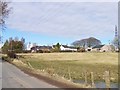
Cairnmuir Road
With the 212m spot height in the background.
Image: © Stephen Sweeney
Taken: 26 Jan 2010
0.20 miles
9
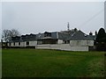
House at East Rogerton
Old farm house north of East Kilbride.
Image: © Stephen Sweeney
Taken: 26 Jan 2010
0.20 miles
10
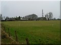
Farmland east of Rogerton
Seen from Markethill Road.
Image: © Stephen Sweeney
Taken: 26 Jan 2010
0.24 miles