
IMAGES TAKEN NEAR TO
Kinloss Place, GLASGOW, G74 4EU
Introduction
This page details the photographs taken nearby to Kinloss Place, G74 4EU by members of the Geograph project.
The Geograph project started in 2005 with the aim of publishing, organising and preserving representative images for every square kilometre of Great Britain, Ireland and the Isle of Man.

There are currently over 7.5m images from over14,400 individuals and you can help contribute to the project by visiting https://www.geograph.org.uk
Image Map
Images are licensed for reuse under creativecommons.org/licenses/by-sa/2.0
Notes
- Clicking on the map will re-center to the selected point.
- The higher the marker number, the further away the image location is from the centre of the postcode.
Image Listing (16 Images Found)
Images are licensed for reuse under creativecommons.org/licenses/by-sa/2.0
Image
Details
Distance
1

Threshold Church, Maxwell Drive, East Kilbride
Image: © Dannie Calder
Taken: 4 Jan 2003
0.17 miles
2
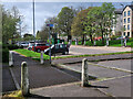
National Cycle Route 756 near East Kilbride railway station
The route runs for 8 miles from Kelvindale in Glasgow to East Kilbride railway station.
Image: © wrobison
Taken: 9 May 2023
0.17 miles
4
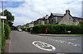
Maxwell Drive and Threshold.
Junction of Maxwell Drive and Threshold.
Image: © John Steven
Taken: 23 Jun 2015
0.19 miles
5

Underpass below the Kingsway, East Kilbride
The Kingsway is the main north-south road and the Queensway is the main east-west road.
Image: © wrobison
Taken: 9 May 2023
0.19 miles
6
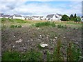
Old Village school site.
Former site of the old Village School to the centre and left. To the right of the photograph was at one time the Neuk Café and the Briquet Factory, also I believe the fire station during the warII.
Image: © John Steven
Taken: 23 Jun 2015
0.20 miles
7
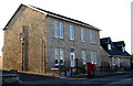
Faichney Field
A restored property in East Kilbride Main Street which was used as offices by the East Kilbride Development Corporation during the early years of the new town
Image: © Willie Mair
Taken: 25 Jul 2008
0.21 miles
8
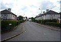
Kirkton Park
Looking along Kirkton Park from its junction with Maxwell Drive.
Image: © John Steven
Taken: 23 Jun 2015
0.22 miles
9
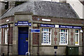
Estate Agents, East Kilbride village
Built during the early New Town developments to house the Glasgow Savings Bank.
Image: © Willie Mair
Taken: 29 Jul 2008
0.22 miles
10
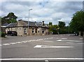
Former Police Station.
Formerly the old East Kilbride Police Station situated at the junction of Main Street and Old Coach Road, now a dentist surgery.
Image: © John Steven
Taken: 23 Jun 2015
0.22 miles