
IMAGES TAKEN NEAR TO
Loch Loyal, GLASGOW, G74 2DE
Introduction
This page details the photographs taken nearby to Loch Loyal, G74 2DE by members of the Geograph project.
The Geograph project started in 2005 with the aim of publishing, organising and preserving representative images for every square kilometre of Great Britain, Ireland and the Isle of Man.

There are currently over 7.5m images from over14,400 individuals and you can help contribute to the project by visiting https://www.geograph.org.uk
Image Map
Images are licensed for reuse under creativecommons.org/licenses/by-sa/2.0
Notes
- Clicking on the map will re-center to the selected point.
- The higher the marker number, the further away the image location is from the centre of the postcode.
Image Listing (12 Images Found)
Images are licensed for reuse under creativecommons.org/licenses/by-sa/2.0
Image
Details
Distance
2
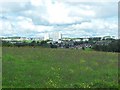
East Kilbride from Calderside Road
Looking over the Saint Leonard's area of the town.
Image: © Stephen Sweeney
Taken: 18 Jul 2011
0.10 miles
3
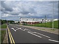
Sanderson High School
On High Common Road and next to Calderglen High School.
Image: © Richard Webb
Taken: 4 Jun 2012
0.17 miles
5
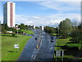
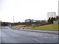
High Common Road, East Kilbride
Viewed from the flyover carrying Strathaven Road, the A726 from East Kilbride to Strathaven.
Image: © G Laird
Taken: 11 Sep 2012
0.20 miles
6
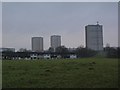
St Leonards houses and tower blocks
The St Leonards area of East Kilbride is viewed from the edge of the wood in Calderglen Country Park, late on a rather dull February afternoon.
Image: © Alec MacKinnon
Taken: 11 Feb 2012
0.20 miles

8
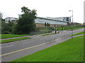
Calderglen High School (?rd-sgoil Ghlinn Challdair)
The Gaelic name in the title of the photograph is also depicted on the front of the building along with the more usual name in English. Calderglen High School is situated on High Common Road and was opened in 2008 after the merger of Hunter High School and Claremont High School.
Image: © G Laird
Taken: 11 Sep 2012
0.21 miles
9

Contrasting scenes, Calderglen Country Park
The tower blocks of East Kilbride come into view from the path bordering Colonsay Field at the Country Park.
Image: © Jim Barton
Taken: 13 Jan 2012
0.22 miles
10
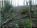
Storm damage in Calderglen Country Park
Storm force winds followed by torrential rain in early January 2012 resulted in high water levels throughout central Scotland and a lot of storm damage.
Image: © Gordon Brown
Taken: 5 Jan 2012
0.24 miles