
IMAGES TAKEN NEAR TO
Scalpay, GLASGOW, G74 2BU
Introduction
This page details the photographs taken nearby to Scalpay, G74 2BU by members of the Geograph project.
The Geograph project started in 2005 with the aim of publishing, organising and preserving representative images for every square kilometre of Great Britain, Ireland and the Isle of Man.

There are currently over 7.5m images from over14,400 individuals and you can help contribute to the project by visiting https://www.geograph.org.uk
Image Map
Images are licensed for reuse under creativecommons.org/licenses/by-sa/2.0
Notes
- Clicking on the map will re-center to the selected point.
- The higher the marker number, the further away the image location is from the centre of the postcode.
Image Listing (7 Images Found)
Images are licensed for reuse under creativecommons.org/licenses/by-sa/2.0
Image
Details
Distance
1
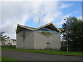
Claremont Parish Church, East Kilbride
Image: © Iain Thompson
Taken: 1 Oct 2005
0.14 miles
2
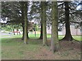
Clump of conifers
A small group of trees beside Blacklaw Drive.
Image: © Richard Webb
Taken: 4 Jun 2012
0.14 miles
3
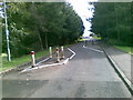
Traffic Calming, Calderglen Road, East Kilbride
Image: © Alex McGregor
Taken: 7 Sep 2010
0.20 miles
4
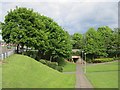
Underpass under High Common Road
Some pedestrian routes in East Kilbride. Unlike other new towns, there seem to be few paths here and signposting is sparse. Steps are common, so not great for wheelchairs.
Image: © Richard Webb
Taken: 4 Jun 2012
0.22 miles
5

Roundabout on St Leonards Road, East Kilbride
At the junction with High Common Road.
Image: © G Laird
Taken: 11 Sep 2012
0.22 miles
6
Roundabout on St Leonards Road, East Kilbride
Image: © Elliott Simpson
Taken: 5 Aug 2011
0.23 miles
7
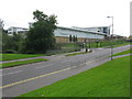
Calderglen High School (?rd-sgoil Ghlinn Challdair)
The Gaelic name in the title of the photograph is also depicted on the front of the building along with the more usual name in English. Calderglen High School is situated on High Common Road and was opened in 2008 after the merger of Hunter High School and Claremont High School.
Image: © G Laird
Taken: 11 Sep 2012
0.23 miles