IMAGES TAKEN NEAR TO
Limeside Avenue, GLASGOW, G73 3PR
Introduction
This page details the photographs taken nearby to Limeside Avenue, G73 3PR by members of the Geograph project.
The Geograph project started in 2005 with the aim of publishing, organising and preserving representative images for every square kilometre of Great Britain, Ireland and the Isle of Man.

There are currently over 7.5m images from over14,400 individuals and you can help contribute to the project by visiting https://www.geograph.org.uk
Image Map
Images are licensed for reuse under creativecommons.org/licenses/by-sa/2.0
Notes
- Clicking on the map will re-center to the selected point.
- The higher the marker number, the further away the image location is from the centre of the postcode.
Image Listing (15 Images Found)
Images are licensed for reuse under creativecommons.org/licenses/by-sa/2.0
Image
Details
Distance
1
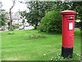
Pillar box on Limeside Avenue
It is situated in a small green space at the head of Dunkeld Avenue.
Image: © Richard Webb
Taken: 29 Jun 2011
0.03 miles
2
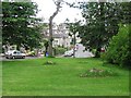
Dunkeld Avenue
A residential street. The view is across a green space in a road triangle.
Image: © Richard Webb
Taken: 29 Jun 2011
0.05 miles
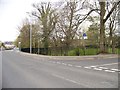
3
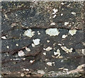
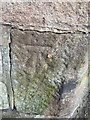
OS Cut Mark: Rutherglen - Number 105 Dryburgh Avenue
Recent site of vehicle collision with wall so hidden behind barrier
Image: © thejackrustles
Taken: 15 May 2022
0.11 miles
4
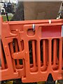
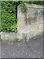
Red crash barriers - Number 105 Dryburgh Avenue
Image: © thejackrustles
Taken: 15 May 2022
0.12 miles
5
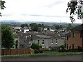
Limeside Avenue
Looking between some of the lime trees at a view over Glasgow.
Image: © Richard Webb
Taken: 29 Jun 2011
0.12 miles
6
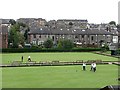
Rutherglen Bowling Club
Greens off Stonelaw Road.
Image: © Richard Webb
Taken: 29 Jun 2011
0.12 miles
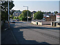
8
Junction of Stonelaw Road and Buchanan Drive
Image: © Elliott Simpson
Taken: 2 May 2013
0.19 miles
9
OS Cut Mark - Rutherglen, Junction Hamilton Road/Calderwood Road
https://www.bench-marks.org.uk/bm126430
Image: © thejackrustles
Taken: 15 May 2022
0.21 miles
10
Location of OS Cut Mark - Rutherglen, Junction Hamilton Road/Calderwood Road
Image: © thejackrustles
Taken: 15 May 2022
0.21 miles