
IMAGES TAKEN NEAR TO
Main Street, GLASGOW, G73 3AY
Introduction
This page details the photographs taken nearby to Main Street, G73 3AY by members of the Geograph project.
The Geograph project started in 2005 with the aim of publishing, organising and preserving representative images for every square kilometre of Great Britain, Ireland and the Isle of Man.

There are currently over 7.5m images from over14,400 individuals and you can help contribute to the project by visiting https://www.geograph.org.uk
Image Map
Images are licensed for reuse under creativecommons.org/licenses/by-sa/2.0
Notes
- Clicking on the map will re-center to the selected point.
- The higher the marker number, the further away the image location is from the centre of the postcode.
Image Listing (19 Images Found)
Images are licensed for reuse under creativecommons.org/licenses/by-sa/2.0
Image
Details
Distance
1
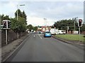
Gallowflat Roundabout
As one travels from Eastfield on the A724, this roundabout marks the fork onto the B768 for Gallowflat. The A724 veers right, under the railway.
Image: © Roger May
Taken: 8 Sep 2005
0.04 miles

4
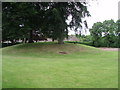
Rutherglen Main Street Tumulus
Grass-covered tumulus burial site (grave mound), believed to be Roman. Located on part of what was the garden of the former 18th century Gallowflat house (now demolished).
Image: © Paul Nardone
Taken: 12 Jun 2008
0.09 miles
5
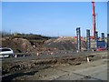
M74 extension
Work to connect the M74 to the M8 in Glasgow's Tradeston area.
Image: © Stephen Sweeney
Taken: 1 Apr 2009
0.12 miles
6
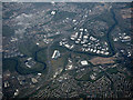
East Glasgow from the air
Junction 9 on the M74 motorway is in the foreground, alongside the West Coast Main Line railway near Rutherglen. The M74 can be seen crossing the River Clyde on Auchenshuggle Bridge. To the right of this bridge can be seen the Argyle Line railway bridge and Cambuslang Road bridge, both also crossing the Clyde. Continuing right, the disused Cambuslang Road bridge and the adjacent disused Rosebank railway bridge can be seen, with the A763 Clydeford Bridge beyond.
Image: © Thomas Nugent
Taken: 1 May 2017
0.13 miles
7

Rutherglen Babcock Rail Depot
With railway infrastructure maintenance stock - Swietelsky, SB RAIL, Plasser & Theurer. The tall 'pylons' beyond support netting around a golfing range.
Image: © M J Richardson
Taken: 15 Aug 2025
0.14 miles
8
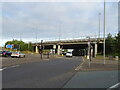
M74 Motorway bridge over Cambuslang Road (A724)
Image: © JThomas
Taken: 16 Sep 2021
0.14 miles
9
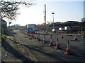
Roadworks on Cambuslang Road
At what will be one of the junctions of the M74 extension.
Image: © Stephen Sweeney
Taken: 1 Apr 2009
0.14 miles
10

Johnhill House Industrial Estate, Cambuslang
A small industrial estate between Cambuslang Road [A724] and the railway.
Image: © M J Richardson
Taken: 15 Aug 2025
0.15 miles