IMAGES TAKEN NEAR TO
King Street, GLASGOW, G73 1DG
Introduction
This page details the photographs taken nearby to King Street, G73 1DG by members of the Geograph project.
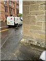
The Geograph project started in 2005 with the aim of publishing, organising and preserving representative images for every square kilometre of Great Britain, Ireland and the Isle of Man.

There are currently over 7.5m images from over14,400 individuals and you can help contribute to the project by visiting https://www.geograph.org.uk
Image Map
Images are licensed for reuse under creativecommons.org/licenses/by-sa/2.0
Notes
- Clicking on the map will re-center to the selected point.
- The higher the marker number, the further away the image location is from the centre of the postcode.
Image Listing (117 Images Found)
Images are licensed for reuse under creativecommons.org/licenses/by-sa/2.0
Image
Details
Distance
1
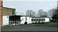
Rutherglen Police Station
On King Street.
Image: © Thomas Nugent
Taken: 30 Mar 2013
0.01 miles
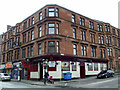
2
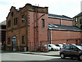
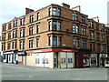
King Street
An old red brick building with an ornate red sandstone front. Further information welcomed.
Image: © Thomas Nugent
Taken: 30 Mar 2013
0.03 miles
3
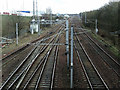
Railway near Rutherglen station
The West Coast Main Line and some local lines converge at this point. Rutherglen station is out of sight to the left. The M74 motorway can be seen on the left.
Image: © Thomas Nugent
Taken: 30 Mar 2013
0.04 miles
4
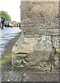
OS Cut Mark - Rutherglen, Farmeloan Road
https://www.bench-marks.org.uk/bm135522
Image: © thejackrustles
Taken: 15 May 2022
0.05 miles
5
Location of OS Cut Mark - Rutherglen, Farmeloan Road
Image: © thejackrustles
Taken: 15 May 2022
0.05 miles
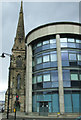
6
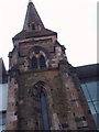
Tower of The United Free Church. Rutherglen
Built in 1872 this 128ft tall tower is all that remains. New offices occupy most of this site now.
Image: © Lynn M Reid
Taken: 24 Mar 2008
0.05 miles
7
Farmeloan Road at King Street
Kins Street is on the left.
Image: © Thomas Nugent
Taken: 30 Mar 2013
0.05 miles
8
Farmeloan Road
From the junction with King Street, looking south to Rutherglen Main Street.
Image: © Stephen Sweeney
Taken: 18 Feb 2009
0.06 miles
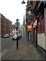
9
The Victoria Bar
On Farmeloan Road at Victoria Street, which is on the right.
Image: © Thomas Nugent
Taken: 30 Mar 2013
0.06 miles
10
Former United Free Church. Rutherglen
On Farmeloan Road, viewed from Main Street.
Image: © Thomas Nugent
Taken: 30 Mar 2013
0.06 miles