IMAGES TAKEN NEAR TO
Cambuslang Road, GLASGOW, G72 7DA
Introduction
This page details the photographs taken nearby to Cambuslang Road, G72 7DA by members of the Geograph project.
The Geograph project started in 2005 with the aim of publishing, organising and preserving representative images for every square kilometre of Great Britain, Ireland and the Isle of Man.

There are currently over 7.5m images from over14,400 individuals and you can help contribute to the project by visiting https://www.geograph.org.uk
Image Map
Images are licensed for reuse under creativecommons.org/licenses/by-sa/2.0
Notes
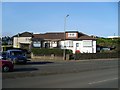
- Clicking on the map will re-center to the selected point.
- The higher the marker number, the further away the image location is from the centre of the postcode.
Image Listing (15 Images Found)
Images are licensed for reuse under creativecommons.org/licenses/by-sa/2.0
Image
Details
Distance
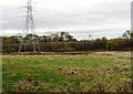
3
Pylons and rugby pitch by Cambuslang Road
Image: © Stephen Sweeney
Taken: 1 Apr 2009
0.06 miles
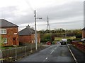
7
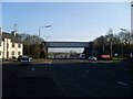
Railway bridge over Bogleshole Road
Looking north from Cambuslang Road.
Image: © Stephen Sweeney
Taken: 1 Apr 2009
0.13 miles
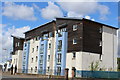
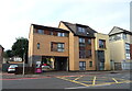
8
Bogleshole Road flats
At the junction with Cambuslang Road.
Image: © Stephen Sweeney
Taken: 1 Apr 2009
0.13 miles
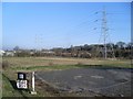
9
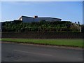
House on a hill above the Gallowflat Roundabout
In Eastfeld.
Image: © Stephen Sweeney
Taken: 1 Apr 2009
0.13 miles
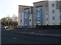
10
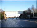
Railway bridge over Bogleshole Road
Image: © Elliott Simpson
Taken: 17 Dec 2011
0.14 miles