IMAGES TAKEN NEAR TO
Maryville Lane, GLASGOW, G71 6EX
Introduction
This page details the photographs taken nearby to Maryville Lane, G71 6EX by members of the Geograph project.
The Geograph project started in 2005 with the aim of publishing, organising and preserving representative images for every square kilometre of Great Britain, Ireland and the Isle of Man.

There are currently over 7.5m images from over14,400 individuals and you can help contribute to the project by visiting https://www.geograph.org.uk
Image Map (Loading...)


Getting Data...Please wait
Leaflet Map data © OpenStreetMap
Images are licensed for reuse under creativecommons.org/licenses/by-sa/2.0
Notes
- Clicking on the map will re-center to the selected point.
- The higher the marker number, the further away the image location is from the centre of the postcode.
Image Listing (28 Images Found)
Images are licensed for reuse under creativecommons.org/licenses/by-sa/2.0
Image
Details
Distance
1
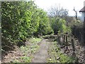
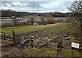
An old road, Calderbraes
This former steep road has long closed and is now a path.
Image: © Richard Webb
Taken: 23 Apr 2012
0.04 miles
2
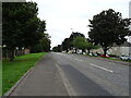
The embankment of Old Edinburgh road
Image: © Stephen Sweeney
Taken: 19 Apr 2010
0.09 miles
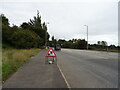
4
Roundabout on the A74
Junction with the B7001.
Image: © JThomas
Taken: 13 Sep 2021
0.12 miles
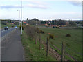
6
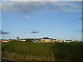
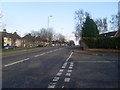
Birkenshaw from Old Edinburgh Road
The village from the bend in Old Edinburgh Road.
Image: © Stephen Sweeney
Taken: 19 Apr 2010
0.16 miles
7
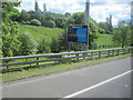
Welcome to South Lanarkshire
Placed at the end of the slip road from the M73 to the southbound M74 at M74 junction 4
Image: © John Firth
Taken: 13 May 2011
0.17 miles
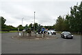
8
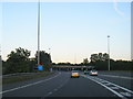
M73/M74 Junction 4 at South Lanarkshire boundary
Image: © Colin Pyle
Taken: 4 Jun 2013
0.19 miles
10
Old Edinburgh Road, Birkenshaw
In North Lanarkshire.
Image: © Stephen Sweeney
Taken: 19 Apr 2010
0.20 miles