IMAGES TAKEN NEAR TO
Drumpellier Avenue, GLASGOW, G69 7DP
Introduction
This page details the photographs taken nearby to Drumpellier Avenue, G69 7DP by members of the Geograph project.
The Geograph project started in 2005 with the aim of publishing, organising and preserving representative images for every square kilometre of Great Britain, Ireland and the Isle of Man.

There are currently over 7.5m images from over14,400 individuals and you can help contribute to the project by visiting https://www.geograph.org.uk
Image Map
Images are licensed for reuse under creativecommons.org/licenses/by-sa/2.0
Notes
- Clicking on the map will re-center to the selected point.
- The higher the marker number, the further away the image location is from the centre of the postcode.
Image Listing (43 Images Found)
Images are licensed for reuse under creativecommons.org/licenses/by-sa/2.0
Image
Details
Distance
1
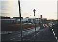
Baillieston, Calderwood Drive
With Caledonia primary school.
Image: © Robert Murray
Taken: 12 Feb 2002
0.07 miles
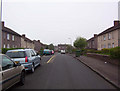
2
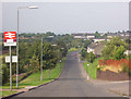
Baillieston, Drumpellier Road
Post-War housing built in 1958. The street is named after the old Drumpellier Estate in Coatbridge.
Image: © Robert Murray
Taken: 18 Jul 2004
0.08 miles
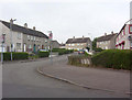
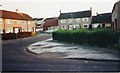
3
Baillieston, Calderwood Drive
The bottom end of the village, there is nowhere lower than this area.
Image: © Robert Murray
Taken: 14 Apr 2004
0.08 miles
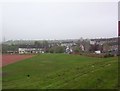
4
Baillieston, Rutherglen to Coatbridge railway
The line runs across the middle of the photo with Baillieston behind.
Image: © Robert Murray
Taken: 28 Nov 2008
0.09 miles
5
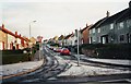
Baillieston, Ash Road
The overnight dusting of snow still lying in the shade of the early morning sun.
Image: © Robert Murray
Taken: 12 Feb 2002
0.10 miles
6
Baillieston, Muirside Street
The hamlet of Muirside was located at the end of this street.
Image: © Robert Murray
Taken: 29 Sep 2008
0.12 miles
7
Baillieston, Fir Place
Like the other two streets built in the late 1950s leading off Old Wood Road this little cul-de-sac was given a tree name.
Image: © Robert Murray
Taken: 12 Feb 2002
0.13 miles
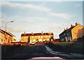
9
Baillieston, Caledonia Road
A steep brae if you are walking towards the Geographer's position. The name of the road relates to the adjacent railway line which was built by the Caldeonian Railway in 1865.
Image: © Robert Murray
Taken: 18 Jul 2004
0.14 miles
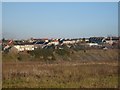
10
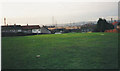
Baillieston, open space
Between Calderwood Drive and Caledonia Road. Once upon a time there were swings and a roundabout here.
Image: © Robert Murray
Taken: 12 Feb 2002
0.14 miles