IMAGES TAKEN NEAR TO
Drumnessie Road, GLASGOW, G68 9HH
Introduction
This page details the photographs taken nearby to Drumnessie Road, G68 9HH by members of the Geograph project.
The Geograph project started in 2005 with the aim of publishing, organising and preserving representative images for every square kilometre of Great Britain, Ireland and the Isle of Man.

There are currently over 7.5m images from over14,400 individuals and you can help contribute to the project by visiting https://www.geograph.org.uk
Image Map
Images are licensed for reuse under creativecommons.org/licenses/by-sa/2.0
Notes
- Clicking on the map will re-center to the selected point.
- The higher the marker number, the further away the image location is from the centre of the postcode.
Image Listing (11 Images Found)
Images are licensed for reuse under creativecommons.org/licenses/by-sa/2.0
Image
Details
Distance
3
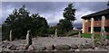
Standing Stones of Broadwood Loch
These stones are as old as the earth itself but they lived somewhere else for millions of years before being fashioned and placed in this decorative circle.
Image: © Robert Murray
Taken: 24 Sep 2009
0.11 miles
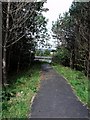
5
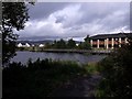
The Broadwood Boardwalk
The second last link in the round the loch path, the last link awaits the builder of the houses in the background to complete the path - as per their contractual agreement with North Lanarkshire Council.
Image: © Robert Murray
Taken: 24 Sep 2009
0.13 miles
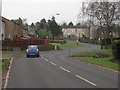
6
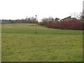
Open land, Westfield
Grassland off Westfield Drive.
Image: © Richard Webb
Taken: 4 Mar 2011
0.15 miles
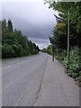
7
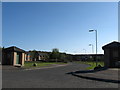
Broadwood Business Park
The entrance to the park in Cumbernauld.
Image: © James Denham
Taken: 18 Apr 2009
0.18 miles
8
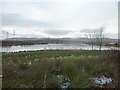
Broadwood Loch
Looking across the loch towards Blackwood from Westfield Road.
Image: © Stephen Sweeney
Taken: 20 Dec 2011
0.20 miles
9
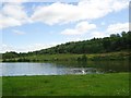
Cumbernauld, Broadwood loch
View towards Westfield which is hidden by the forest.
Image: © Robert Murray
Taken: 23 Jul 2011
0.21 miles
10
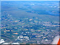
North Lanarkshire and the Kilsyth Hills
Looking north-northwest from over Newmains. The road running across the lower part of the picture is the M80, with J4 and M73 J3 at the left. The Westfield Industrial Estate, including the home of Barr's Irn Bru, is also at lower left http://www.geograph.org.uk/search.php?i=85514316 . Just to the right is Broadwood Loch. At upper left is the Carron Valley Reservoir and Forest.
Image: © M J Richardson
Taken: 5 Jul 2018
0.21 miles