IMAGES TAKEN NEAR TO
Mossywood Road, GLASGOW, G68 9DX
Introduction
This page details the photographs taken nearby to Mossywood Road, G68 9DX by members of the Geograph project.
The Geograph project started in 2005 with the aim of publishing, organising and preserving representative images for every square kilometre of Great Britain, Ireland and the Isle of Man.

There are currently over 7.5m images from over14,400 individuals and you can help contribute to the project by visiting https://www.geograph.org.uk
Image Map
Images are licensed for reuse under creativecommons.org/licenses/by-sa/2.0
Notes
- Clicking on the map will re-center to the selected point.
- The higher the marker number, the further away the image location is from the centre of the postcode.
Image Listing (16 Images Found)
Images are licensed for reuse under creativecommons.org/licenses/by-sa/2.0
Image
Details
Distance
1
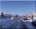
Cumbernauld, Westfield Drive
Day 6 of the early winter snows of 2010.
Image: © Robert Murray
Taken: 1 Dec 2010
0.05 miles
2
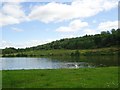
Cumbernauld, Broadwood loch
View towards Westfield which is hidden by the forest.
Image: © Robert Murray
Taken: 23 Jul 2011
0.14 miles
3
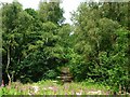
Cumbernauld, Westfield Woods
Path leading to road.
Image: © Robert Murray
Taken: 23 Jul 2011
0.15 miles
4
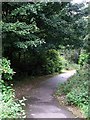
The Westfield Woods
Path from Westfield to Broadwood Loch.
Image: © Robert Murray
Taken: 24 Sep 2009
0.16 miles
5
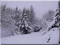
Cumbernauld, Westfield woods
A walk in a snowstorm more like a scene from Dr. Zhivago, at this stage the snow was 2ft. deep and much deeper in the drifts.
Image: © Robert Murray
Taken: 1 Dec 2010
0.16 miles
6
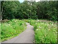
Cumbernauld, Westfield Woods
Path leading to footbridge over the Moss Water Burn.
Image: © Robert Murray
Taken: 23 Jul 2011
0.17 miles
7
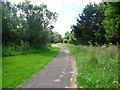
Cumbernauld, Westfield Woods
Path leading to Broadwood Loch.
Image: © Robert Murray
Taken: 23 Jul 2011
0.17 miles
8
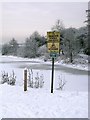
Broadwood Loch Warnings
At the time the ice was approx 6 to 8ins thick. This water froze about 15 Dec 09 and was still frozen over on 4 Feb. 10.
Image: © Robert Murray
Taken: 24 Dec 2009
0.18 miles
9
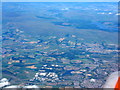
North Lanarkshire and the Kilsyth Hills
Looking north-northwest from over Newmains. The road running across the lower part of the picture is the M80, with J4 and M73 J3 at the left. The Westfield Industrial Estate, including the home of Barr's Irn Bru, is also at lower left http://www.geograph.org.uk/search.php?i=85514316 . Just to the right is Broadwood Loch. At upper left is the Carron Valley Reservoir and Forest.
Image: © M J Richardson
Taken: 5 Jul 2018
0.18 miles