IMAGES TAKEN NEAR TO
Gainburn Crescent, GLASGOW, G67 4QN
Introduction
This page details the photographs taken nearby to Gainburn Crescent, G67 4QN by members of the Geograph project.
The Geograph project started in 2005 with the aim of publishing, organising and preserving representative images for every square kilometre of Great Britain, Ireland and the Isle of Man.

There are currently over 7.5m images from over14,400 individuals and you can help contribute to the project by visiting https://www.geograph.org.uk
Image Map
Images are licensed for reuse under creativecommons.org/licenses/by-sa/2.0
Notes
- Clicking on the map will re-center to the selected point.
- The higher the marker number, the further away the image location is from the centre of the postcode.
Image Listing (21 Images Found)
Images are licensed for reuse under creativecommons.org/licenses/by-sa/2.0
Image
Details
Distance
1
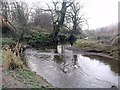
On the Luggie
The blue plastic bag (scourge of the countryside) illustrates how high the water level had been during the November floods.
Image: © Robert Murray
Taken: 10 Dec 2009
0.08 miles
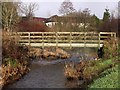
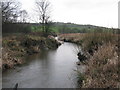
3
Footbridge over the Luggie Water
Just outside Condorrat.
Image: © G Laird
Taken: 5 Jan 2014
0.09 miles
4
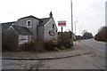
Dalshannon Farm Restaurant (unoccupied)
Image: © Texas Radio and The Big Beat
Taken: 8 Mar 2010
0.09 miles
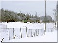
5
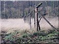
Dalshannon, old Compound
Not a bit of wire left.
Image: © Robert Murray
Taken: 10 Dec 2009
0.10 miles
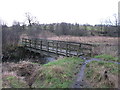
6

Luggie Water at old mill lade
It is at this bend in the river that a dam diverted a flow into the lade that fed Woodmill (corn) a quarter of a mile downstream.
Image: © Robert Murray
Taken: 10 Dec 2009
0.11 miles
7
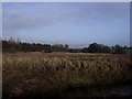
Flood Plain, Luggie Water.
A Haugh in Scots parlance, this is an alluvial plain in geological terms.
Image: © Robert Murray
Taken: 10 Dec 2009
0.13 miles
8
Luggie Water
A stretch of Luggie Water between Mollinsburn and Condorrat.
Image: © G Laird
Taken: 5 Jan 2014
0.15 miles
9
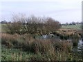
Depression in the field
This could be due to the high water table or subsidence due to mineral workings.
Image: © Robert Murray
Taken: 10 Dec 2009
0.18 miles
10
Christmas Eve traffic on A80
The fencing in the foreground is a barrier to the ongoing upgrade of this road to a motorway.
Image: © Robert Murray
Taken: 24 Dec 2009
0.19 miles