IMAGES TAKEN NEAR TO
Dunnswood Road, GLASGOW, G67 3EN
Introduction
This page details the photographs taken nearby to Dunnswood Road, G67 3EN by members of the Geograph project.
The Geograph project started in 2005 with the aim of publishing, organising and preserving representative images for every square kilometre of Great Britain, Ireland and the Isle of Man.

There are currently over 7.5m images from over14,400 individuals and you can help contribute to the project by visiting https://www.geograph.org.uk
Image Map
Images are licensed for reuse under creativecommons.org/licenses/by-sa/2.0
Notes
- Clicking on the map will re-center to the selected point.
- The higher the marker number, the further away the image location is from the centre of the postcode.
Image Listing (11 Images Found)
Images are licensed for reuse under creativecommons.org/licenses/by-sa/2.0
Image
Details
Distance
1
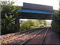
Wardpark Farm (remains), Broom Road
See www.geograph.org.uk/photo/1782940 for more info.
Image: © Texas Radio and The Big Beat
Taken: 2 Apr 2010
0.14 miles
2
Broom Road, Wardpark
Formerly Slamannan Road.
Image: © Texas Radio and The Big Beat
Taken: 2 Apr 2010
0.15 miles
3
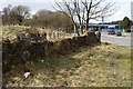
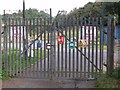
Wardpark Farm (remains), Broom Road
At the top end of Broom Road (formerly Slamannan Road) are the
remains of what is likely to be parts of Wardpark Farm, which was demolished
when the new-town was built. The visible remains are probably parts of the
perimeter walls. A stone gate-post is also visible to left of picture.
Image: © Texas Radio and The Big Beat
Taken: 2 Apr 2010
0.15 miles
5
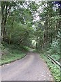
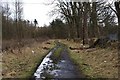
Cumbernauld, road to Dunswood WTW
The photo belies the incline, this is a serious brae.
Image: © Robert Murray
Taken: 12 Sep 2009
0.16 miles
6
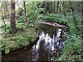
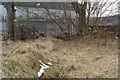
Cumbernauld, the Red Burn
The Red Burn is the headwaters of the Bonny Water and flows to the Carron and downwards to the Firth of Forth at Grangemouth.
Image: © Robert Murray
Taken: 12 Sep 2009
0.16 miles
8
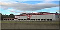
Cumbernauld, Dunnswood Water Treatment Works
This facility treats the sewage from the eastern/northern suburbs of Cumbernauld. It is well hidden deep in the glen that the Red Burn flows through.
Image: © Robert Murray
Taken: 12 Sep 2009
0.17 miles
9
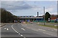
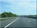
Forest Road / A80
The point where the A80 crosses over Forest Road.
The bridge carrying the A80 is being upgraded (widened)
along with the dual-carriageway.
Image: © Texas Radio and The Big Beat
Taken: 2 Apr 2010
0.18 miles