
IMAGES TAKEN NEAR TO
Mid Road, GLASGOW, G67 2TT
Introduction
This page details the photographs taken nearby to Mid Road, G67 2TT by members of the Geograph project.
The Geograph project started in 2005 with the aim of publishing, organising and preserving representative images for every square kilometre of Great Britain, Ireland and the Isle of Man.

There are currently over 7.5m images from over14,400 individuals and you can help contribute to the project by visiting https://www.geograph.org.uk
Image Map
Images are licensed for reuse under creativecommons.org/licenses/by-sa/2.0
Notes
- Clicking on the map will re-center to the selected point.
- The higher the marker number, the further away the image location is from the centre of the postcode.
Image Listing (28 Images Found)
Images are licensed for reuse under creativecommons.org/licenses/by-sa/2.0
Image
Details
Distance
1
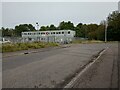
Amey Blairlinn Depot
Amey provides highway maintenance for North Lanarkshire
Image: © Jim Smillie
Taken: 30 Sep 2023
0.16 miles
3
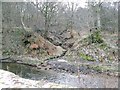
Rivulet
In older times called a 'rill'. This little addition to the Luggie Water comes down from the heights of the modern industrial estate called Blairlinn. It may be natural, it may be surface run off.
Image: © Robert Murray
Taken: 6 Mar 2010
0.17 miles
4
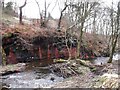
Mineral Waterfalls
Oxydised water falling into the Luggie from a wrecked riverbank.
Image: © Robert Murray
Taken: 6 Mar 2010
0.17 miles
5
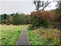
Path alongside Luggie Water
An app identified bush on right as Highbush Cranberry
Image: © Jim Smillie
Taken: 30 Sep 2023
0.18 miles
6
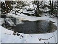
Small Waterfall and Pool
Too cold for skinny dipping!
See also Robert Murray's picture of what I'm sure is the same thing www.geograph.org.uk/photo/1495510
Image: © Texas Radio and The Big Beat
Taken: 10 Jan 2009
0.18 miles
7
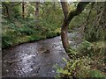
Luggie Water
In Luggiebank Wood Nature Reserve
Image: © Jim Smillie
Taken: 30 Sep 2023
0.18 miles
8
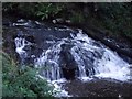
Luggie Water, ruin of old sluice
This looks like a natural waterfall but is actually the ruins of the weir that raised the water level in order to supply the mill lead to Lenzie [pronounced 'Lingie'] corn and flax mills.
Image: © Robert Murray
Taken: 18 Sep 2009
0.19 miles
9
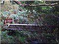
Luggie Water, mystery bridge
No obvious explanation but it could well be encased pipes.
Image: © Robert Murray
Taken: 18 Sep 2009
0.19 miles
10
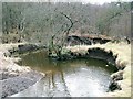
New courses
The Luggie Water seems to be cutting a new course from the evidence in this photo. Recent snow melt seems to have provided sufficiently strong spates which cut into the banks, the result of which is a new alignment.
Image: © Robert Murray
Taken: 6 Mar 2010
0.19 miles