IMAGES TAKEN NEAR TO
Lenziemill Road, GLASGOW, G67 2RL
Introduction
This page details the photographs taken nearby to Lenziemill Road, G67 2RL by members of the Geograph project.
The Geograph project started in 2005 with the aim of publishing, organising and preserving representative images for every square kilometre of Great Britain, Ireland and the Isle of Man.

There are currently over 7.5m images from over14,400 individuals and you can help contribute to the project by visiting https://www.geograph.org.uk
Image Map
Images are licensed for reuse under creativecommons.org/licenses/by-sa/2.0
Notes
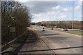
- Clicking on the map will re-center to the selected point.
- The higher the marker number, the further away the image location is from the centre of the postcode.
Image Listing (24 Images Found)
Images are licensed for reuse under creativecommons.org/licenses/by-sa/2.0
Image
Details
Distance
1
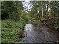
Looking Upstream
Luggie Water flowing through wooded area
Image: © Jim Smillie
Taken: 30 Sep 2023
0.06 miles
2
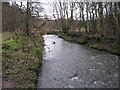
Luggie Water
A straight section of the Luggie Water near Luggiebank.
Image: © G Laird
Taken: 5 Jan 2014
0.07 miles
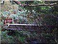
3
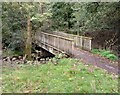
Wooden Footbridge
Access over Luggie Water to/from Blairlinn Industrial Estate
Image: © Jim Smillie
Taken: 30 Sep 2023
0.08 miles
4
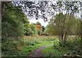
Luggie Wood Nature Reserve
Obvious signs of autumn
Image: © Jim Smillie
Taken: 30 Sep 2023
0.09 miles
5
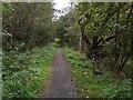
Path through nature reserve
Alongside Luggie Water
Image: © Jim Smillie
Taken: 30 Sep 2023
0.12 miles
6
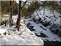
The Luggie In Midwinter
Image: © Texas Radio and The Big Beat
Taken: 10 Jan 2010
0.14 miles
7
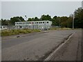
Amey Blairlinn Depot
Amey provides highway maintenance for North Lanarkshire
Image: © Jim Smillie
Taken: 30 Sep 2023
0.14 miles
8
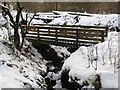
Wooden Bridge In Luggie Glen
Not a bridge over the Luggie but over a small burn (which joins
the Luggie a few yards further ahead).
Image: © Texas Radio and The Big Beat
Taken: 10 Jan 2010
0.15 miles
9
Jane's Brae
The name "Jane's Brae" appears on really old OS maps and was therefore in
use long before this road was built; when this stretch was just a grassy hill.
Note the old and disused information sign which was probably placed
there when the road was built many decades ago.
Image: © Texas Radio and The Big Beat
Taken: 2 Apr 2010
0.17 miles
10
Luggie Water, mystery bridge
No obvious explanation but it could well be encased pipes.
Image: © Robert Murray
Taken: 18 Sep 2009
0.18 miles